Whether for hiking, sightseeing, skiing, camping, or solitude, mountain lovers are always on the lookout for new peaks to explore.
Approximately 20 percent of Earth has mountainous terrain, and one country has way more than all the others.
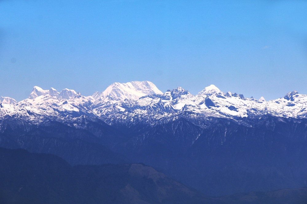
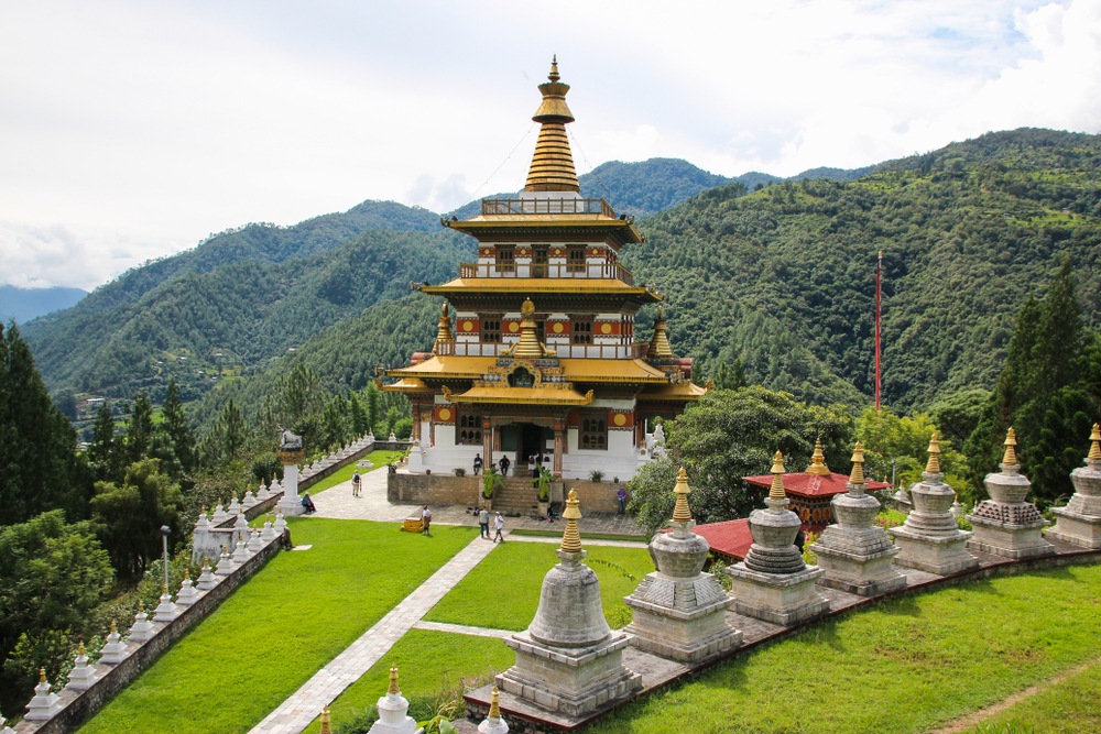
Located in the Himalayas, Bhutan is the most mountainous country in the world with an average elevation of 10,760 feet.
The highest point in the country is Gangkhar Puensum, which is located in the country’s northern region and hovers 24,840 feet above sea level. Gangkhar Puensum is also the world’s highest untouched peak.
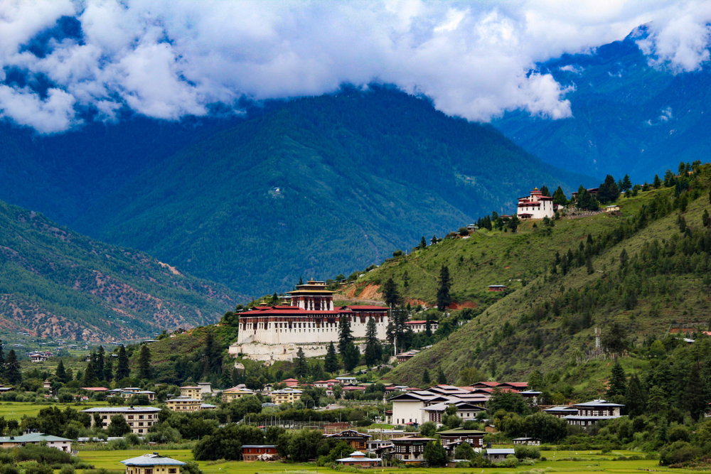
The southern region of Bhutan, with its peaks, ridges, and ravines, is home to the majority of Bhutan’s inhabitants.
Table of Contents
What is Bhutan and where is it located?
The Kingdom of Bhutan, a sovereign state in the Himalayan mountain range, is located at the range’s easternmost tip. Bhutan is bordered by China and India but is also near Myanmar, Bangladesh, and Nepal.
The total length of Bhutan’s borders is 1139 kilometers.
What is the climate like in Bhutan?
Monsoons affect Bhutan’s climate, which is as diverse as its elevation. Around 60% to 90% of the area’s rainfall comes from monsoons in western Bhutan.
Throughout the southern plains and foothills, the climate is warm, moist, and subtropical. In the south and central Himalayan valleys, it is moderate; and in the north, it is chilly, with snow covering the highest peaks year-round.
In Bhutan, why are glaciers so important?
A major renewable water supply for Bhutan’s rivers are the glaciers in its northern region, which in the 1980s encompassed around 10% of the country’s total landmass.
Water from the glaciers flows into Bhutan thanks to their constant supply of fresh snow and delayed melting in the summer.
Monsoon-swollen rivers are made even more so by glacial melt, and this causes floods. Glacier lake outburst floods (GLOFs), also known as jökulhlaups, can endanger downstream settlements when glacial action momentarily interrupts river flows.
When and why did Bhutan’s glaciers start to melt?
Many Bhutanese lakes are on the verge of bursting their banks and sending millions of gallons of stormwater downhill as glaciers recede due to rising temperatures, UN research said in 2008.
The South Asian Regional Health Emergency Fund was established in Thimphu in September 2007 as a result of this research in an effort to combat flooding from global warming.
Why does the UN believe Bhutan’s glaciers are threatened?
Although a UN study in 2008 predicted that Himalayan glaciers would simply vanish within the next 25 years, Prime Minister Jigme Thinley voiced concern in a 2010 press conference, saying, “Our icecaps are drifting away very quickly so we have reason to be concerned that they may simply vanish not in 2035, but even sooner.”
According to the Bhutan Glacial Inventory 2018, Bhutan’s northernmost boundaries comprise 700 glaciers with a total land area of 629,550.02 sq km.
Are there glacial lakes in Bhutan’s mountains?
Pure mountainous lakes and 2,674 glacier lakes are found in Bhutan, and roughly 25 of those glacial lakes are at risk of flooding.
Bhutan’s non-glacial lakes have a combined surface area of around 4,250 hectares (16.4 sq mi). Nearly all of these mountain ranges are higher than 3,500 meters (11,500 ft) but have no fixed habitations, however, some are utilized for yak rearing and could have a few transient encampments.
What are Bhutan’s geographical zones called?
Bhutan has several geographical zones, including the Sub-Himalayan Range, Lower Himalayan Range, and the Great Himalaya, all of which are defined by Bhutan’s highlands.
Near the Bhutan-China border, the Great Himalaya fluctuates in altitude from roughly 18,000 feet to about 24,600 feet.
There is an expanse of glaciated mountains and a cold climate in the northernmost regions.
What type of transportation is used in Bhutan?
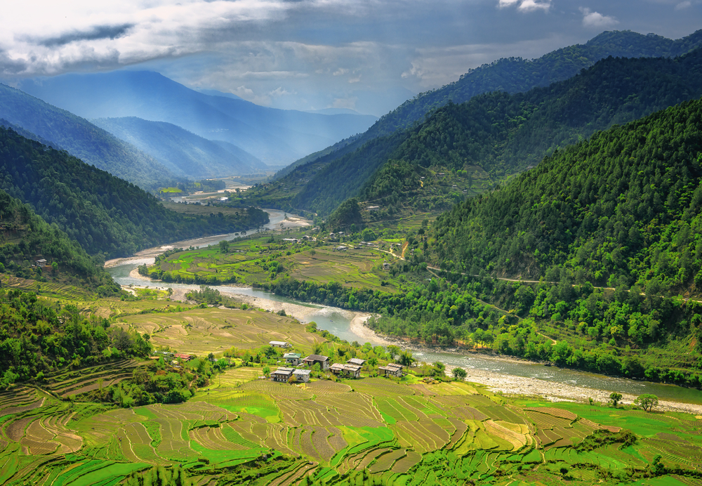
The Himalayas are sculpted into Bhutan’s valleys because of its rivers, which are supplied by melting glaciers and monsoon rainfall. The rocky southerly slopes of the Inner Himalaya divide most of Bhutan’s valleys as well as its lowlands, where the majority of the country’s people live.
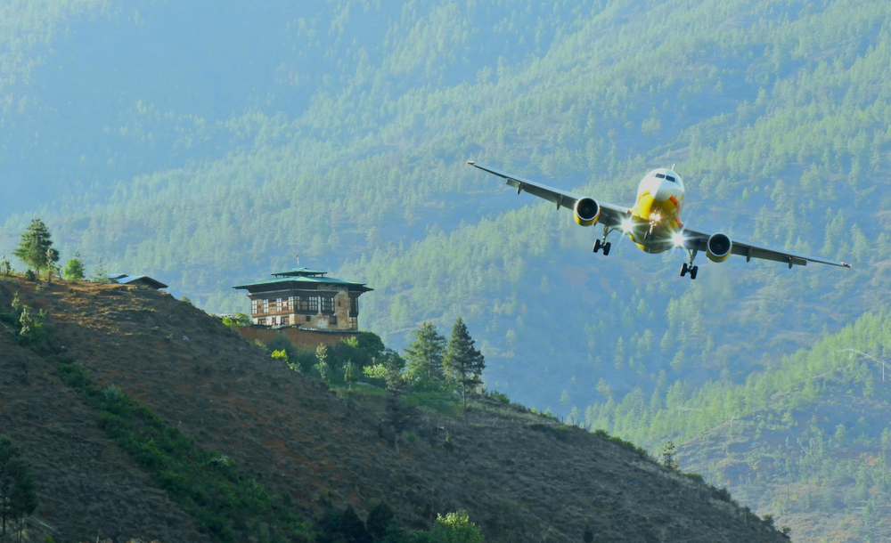
Bhutan’s transportation infrastructure, particularly its national highway system, has been modernized and developed, although getting from one valley to another is tough. The Black Mountains throughout middle Bhutan encircle the western lowlands.
The Drangme and Sankosh Rivers meet in these mountains, which act as watersheds and separate the eastern valleys from central plains. Numerous unique cultural and linguistic groupings can be found in the more remote alpine valleys.
How did Bhutan get its nickname?
Several important Himalayan mountain passes fall under the sovereignty of Bhutan, notably those that connect Tibet and Assam.
Bhutan has earned the moniker “Mountain Fortress of the Gods” due to its historical policy of isolationism and the fact that the only way to enter the country is through these mountain passes.
Due to its rugged interior, Bhutan was never successfully conquered by British forces.
How do people make a living in Bhutan?
Tourism is one of Bhutan’s main industries, but the country also relies on agriculture, hydroelectric power, and forestry to generate income. This region’s mountain valleys – which are supplied by snow-fed rivers – serve as pastures for migrating shepherds to care for their sheep.
What makes Bhutan’s position so important?
Located between China and India, Bhutan has always been a prospective battlefield for Sino-Indian tensions.
Apart from the 1949 Indo-Bhutan Treaty’s foreign relations policies. As a result, the Indian Army has had a significant impact on Bhutan’s road infrastructure.
In addition, the Indian government continues to support almost 60 percent of Bhutan’s public spending. Tibetans have deep cultural, institutional, and religious affiliations to Bhutan because of the Chinese invasion of Tibet from 1949 until 1959.
Is there a reason Bhutan’s ecosystem is well-protected?
Bhutan has one of the planet’s most pristine ecosystems thanks to generations of isolation, a low population, and harsh topography. In terms of species concentration, the nation placed among the top ten in the world.
There are more than 550 known plant species, of which about 300 are regarded as therapeutic. Numerous rare and threatened species, such as the red panda and the snow leopard, are some of the more than 750 bird and 165 animal species that have been identified in Bhutan so far.
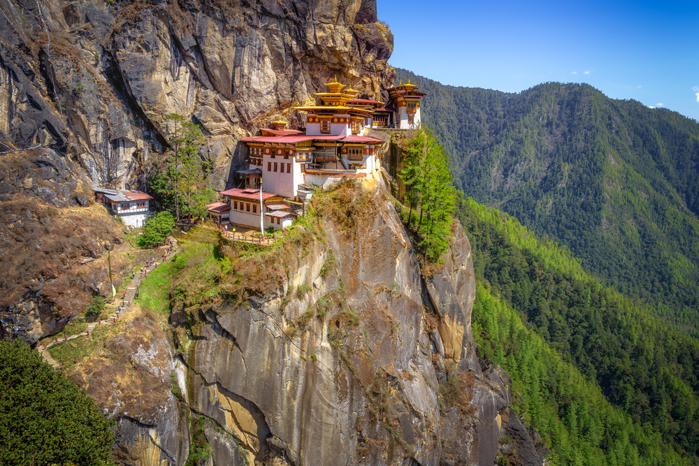
Why do Bhutan’s unclimbed peaks remain untouched?
To date, no one has made it to the summit of Bhutan’s 7,570-meter-tall Gangkhar Puensum.
Since 1994, when Bhutan banned any mountain climbing beyond 6,000 m (20,000 ft) citing its spiritual/religious views, Gangkhar Puensum has been off-limits to hikers.
Locals regard the mountain as an important spiritual site, plus there’s the lack of high-altitude emergency supplies available other than what they can access from India.
In 2003, the Bhutanese government extended the ban on climbing in Bhutan to include all forms of climbing. As long as the Bhutanese government outlaws climbing Gangkhar Puensum, it is unlikely that anyone will attempt to ascend the mountain.
Are there any mountains in Bhutan we can climb?
It’s possible to go hiking, but not in the protected regions. Here are some of the best ways to explore Bhutan’s mountainous areas.
Snowman Trek
In terms of Bhutanese hiking, the Snowman Trek is considered the most difficult path in the world, taking 27 days to complete.
There are breathtaking views of the Himalayas and awe-inspiring vistas to be seen on this walk. There aren’t many towns or communities along the way because you’ll be in a remote section of the nation, so keep that in mind when planning your trip.
Dagala Thousand Lakes
The Dagala Thousand Lakes Trail leads you across rhododendron forests as well as grasslands over the course of six days. You’ll leave the village of Tsheregang and head towards the Himalayan mountain range to begin this journey.
You’ll soon find yourself in the Himalayas, where you’ll be able to see the Kanchenjunga mountainous region in both India and Nepal. It’s possible to observe Mount Everest on the horizon on this hike if the sky is clear and you’re fortunate.
Is a visa required for a trip to Bhutan?
To come into the country, visitors from countries other than the Maldives, Bangladesh, and India must apply for a visa before arrival. You can only visit Bhutan with a visa and as part of the Bhutanese tour business.
It’s vital to mention that all visitors to Bhutan must pay a minimum daily package charge, which includes the cost of food, a 3-star accommodation, a knowledgeable guide, as well as transportation inside Bhutan.
If you want to pay more than the minimum daily package rate, the Bhutanese government allocates some of the funds to sustainable development.
What country has the next largest mountain range after Bhutan?
Nepal has an average elevation of 10,715 feet, making it the second most mountainous country in the world behind Bhutan. Located in Nepal, Mount Everest, the world’s tallest peak, stands at 29,035 feet and can be seen from Bhutan.
Next is Tajikistan, which has an average altitude of 3,045 meters (10,455 feet). There are numerous high mountains and earthquakes in Tajikistan because the country is located in a seismic belt.
The highest point in Tajikistan’s Turkestan Range is 18,077 feet above sea level.