Every river is signified by a number of moving parts, with each river being divided into three main sections. Those are the upper, lower, and middle courses of a river.
Then, there are additional sections of rivers that include the watershed, the delta, headwaters, flow, and more.
In the United States alone, there are over three and one-half million miles of rivers, and they range from small trickling water flows to tremendous bodies of water.
There are approximately 250,000 rivers in the United States in total.
There are hundreds of thousands of rivers in the world, with less than 100 rivers in the world being over 1,000 miles long. There is no one river in the world that is identical to another, but the moving parts are all the same.
Table of Contents
What role do rivers play in the water cycle?
Rivers are an important component of the water cycle and feed into larger bodies of water. The different parts of a river are part of the larger river system and include the upper course, the lower course, and the middle course.
After that, there are many components of a river that define them as such. Those include channels, tributaries, watersheds, the delta of a river, what a riverbank really is, to name a few.
What is a river?
Even though there are hundreds of thousands of rivers in the world that cover millions of miles, it is still estimated that rivers cover approximately 0.1 percent of the planet.
A river is a flowing body of water that is typically freshwater. Freshwater is water that has a very low concentration of salt or waste, such as silt.
Rivers have a natural water flow pattern that follows the energy of gravity. Every river is noted as a river when it flows to a particular body of water such as a lake, sea, or ocean.
Sometimes, rivers flow into the ground and create areas known as wetlands.
Many people mistake rivers for smaller bodies of water such as creeks, brooks, or streams. You will know a river when you see it flowing into a larger body of water.
How do rivers grow?
Rivers are an integral component of the water cycle, which cycles the water on the planet. Rivers will collect water through rain and other forms of precipitation and other bodies of water such as springs or even groundwater.
This water then moves towards larger bodies of water or drainage basins.
When climates change during the seasons, that water then moves upwards, evaporating into a different form. It continues upwards, and as the temperature changes again, it becomes clouds.
How are rivers important to cities?
The locations of cities and rivers are important, and it is important to note that rivers came first. Many cities are built around large bodies of water to make life conducive to trade and healthy living.
When settlements first began around rivers, long before the Industrial Revolution, settlers needed water for everything from bathing to drinking to bathing. Rivers were the natural resources needed to accomplish these things.
Today, rivers are still fundamental to a city’s success, providing water for electricity, food, and transport.
What are the main components of a river?
The main components of a river are the upper course, the lower course, and the middle course. The upper course of a river is the river that is the closest section of the river to the river’s source.
So, if a river is fed by springs, the upper course is the section near the spring.
The upper course of a river is typically near higher land, as water travels downwards, or, downstream due to gravity. In many cases, the source of a river is in the mountains.
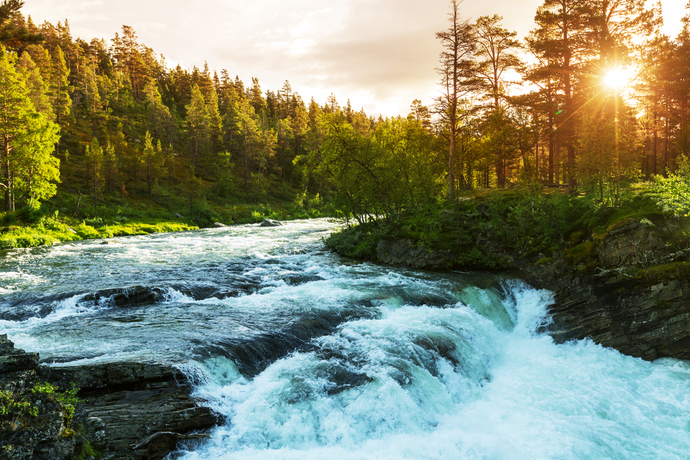
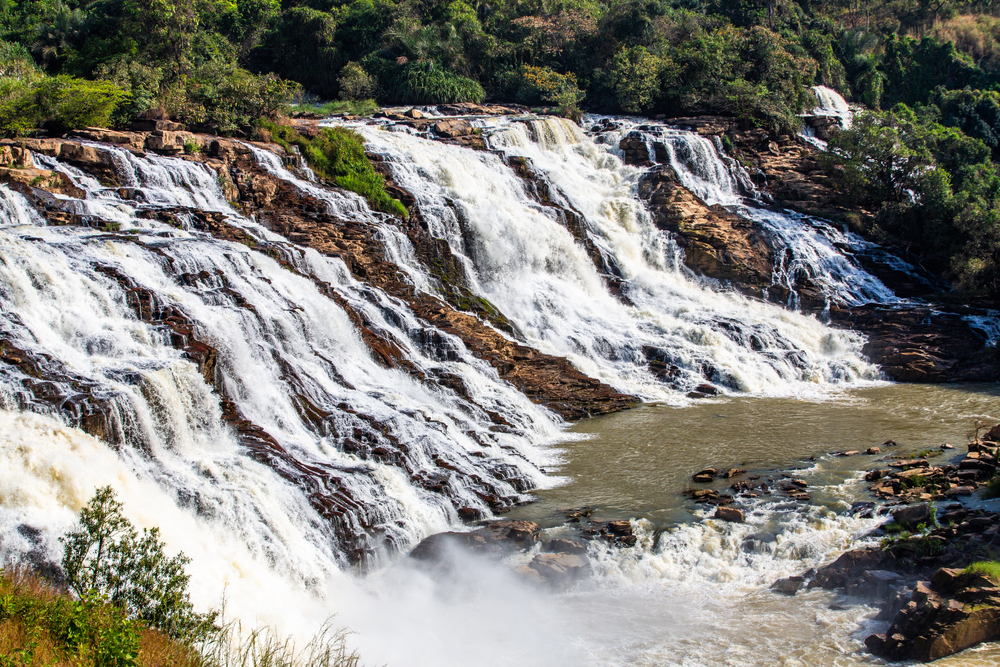
The steeper the gradient of a river, the faster the water will flow. The upper course of the river typically contains a lot of erosion. It is in the upper course where you will find the most problems, such as rapids, waterfalls, and even pot-holes, and this area is often considered the most dangerous part of any river.
Some valleys and spurs can crop up here too.
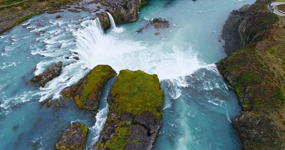
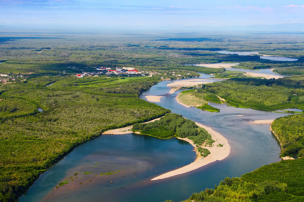
The middle course of a river is the largest part of a river. Here is where the floodplains, the oxbows, and the meanders are. The last section of a river is called the lower course.
Here, the gradient is smaller, as it gets closer to the large body of water that it feeds into. Rivers will typically slow down and be less dangerous in this section of the water, however, the water they feed into could pose some danger.
What is a watershed?
The word “watershed” is used frequently when it comes to rivers, as it is typically the source of the river. In many cases, it is multiple sources that drain into a basin that feeds a river.
A watershed can be visualized as the area of land where rainwater and snow collect to form into a river basin that helps to form a river.
It is a plot of land of sorts, or a mass of land that collects water to feed into one body of water such as a river. So a county, for example, could have land divides marked into it that denote the watershed lines.
You might hear this word on the news during a flood or federal emergency. It refers to a section of land where water is flowing into one major river source, such as a river or stream.
It is an important part of river development and maintenance of the river.
When there is flooding, experts and authorities will look to the watershed to determine what the problem is at the source of the river basin, and it could be anywhere in that watershed.
How many watersheds are in America?
There are watersheds in the United States as large as 1.5 million acres.
From a climate change perspective, the size of a watershed can provide an optimistic outlook on the life cycle of rivers, a critical component of any healthy ecosystem.
From the watershed, the river runs its course and moves towards the delta or the end of a river.
When the rivers are larger, watersheds and floodplains are important components of the river system that work together.
What are tributaries?
Tributaries are rivers that feed into rivers, as opposed to rivers that wind into the oceans or lakes. When a river is large, its water is not going to be contained to its one location.
It can and will have an overflow. Tributaries are good things in the world of climate change and healthy ecosystems and also for survival for the species around them.
One problem can arise when it comes to tributaries, and that is just in determining where the tributaries are. In some cases, like the Mississippi or the Hudson River tributaries, they are exactly what we know them to be and where they are.
However, there are some rivers that we don’t really know about with that much certainty.
Does it end there? Did it start there? What’s that thing? That “thing” is often a tributary. In a river such as the Mississippi River, the tributaries are well known and documented.
Where does a river begin and end?
A river begins at the mouth, and upstream is the original source of the river’s headwater. The headwater is another term for the beginning of the river.
Other parts of a river are River Left and River Right. Those terms are exactly what they mean. You might see an old tin can floating downstream on River Right for example.
That is how it would be described if you were documenting it.
Headwaters are another portion of the river at the beginning of the river that functions as a source of the river water. They can be huge, or they can be springs trickling into the river.
Headwaters are examined thoroughly during a crisis or for pollution analysis. Their health will help predict the health of the entire ecosystem in an instant.
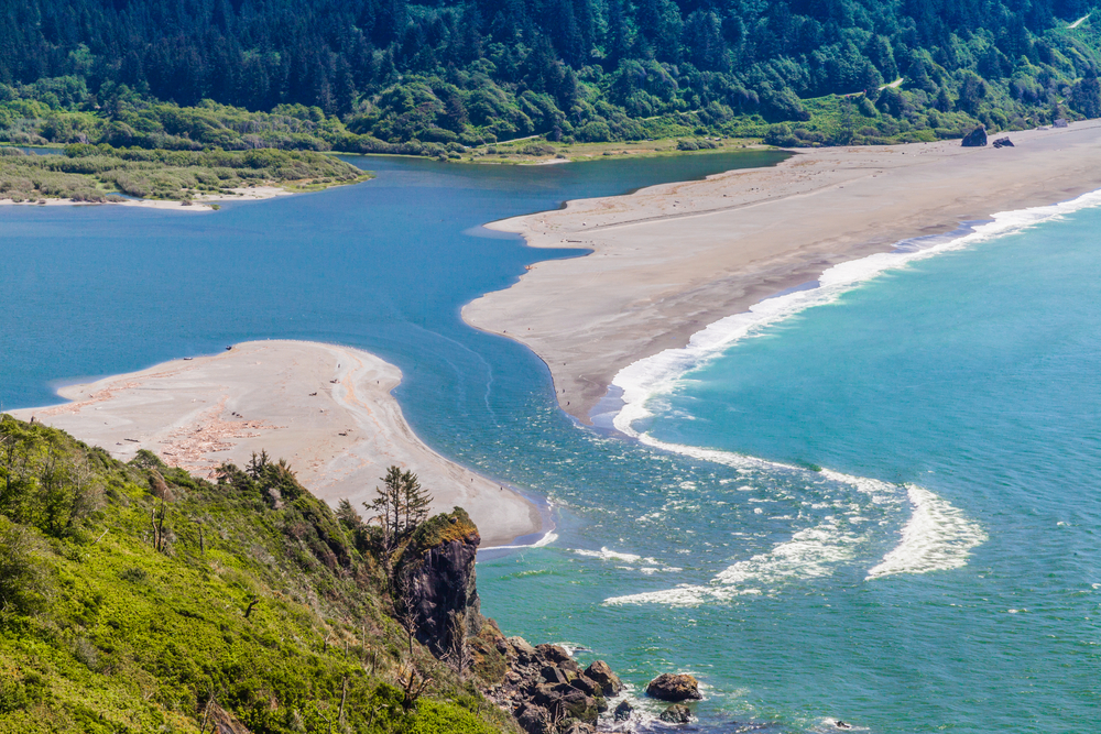
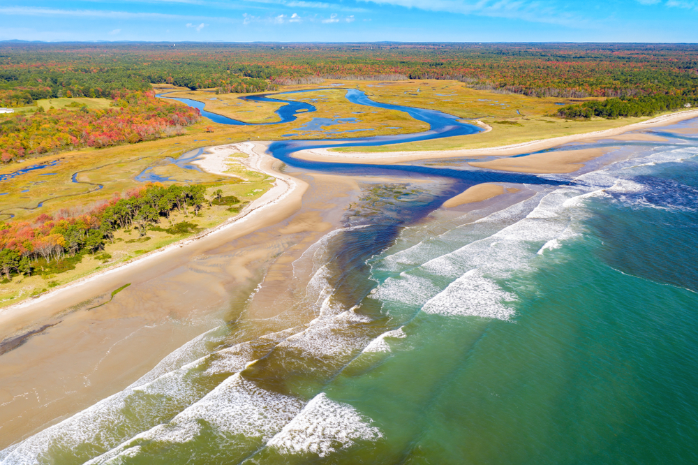
The delta is the portion of the river where the river ends. A river has a steep gradient in some areas and is flat and lower in other areas as it winds to an end at its delta point.
Where you see this flattening is the delta of the river, and it often looks fan-shaped. That is just the natural way that water flows.
If you spill a glass of water on a table, you will see a fan-shaped pattern happening on a flat surface. Delta formations in land masses are the same.
The river forms the delta at the point the river comes to an end and joins its larger body of water.
Are riverbanks important?
Any part of a river is important, as it was formed by the ecosystem that started the river. The riverbanks are no exception. Just beyond the riverbanks are floodplains.
The riverbanks are just what you think – the banks along the sides of the river.
They aren’t just safety zones for walking or sunbathing, they are areas rich in nutrients that wildlife and other species are very attracted to and rely on.
You’ll see birds along riverbanks for this very reason. The banks will be home to water washing up insects, worms, and other vegetation for many different kinds of species to enjoy and live off of.
What are floodplains?
Floodplains are the areas of land just beyond riverbanks. These areas are in the most danger when the river water runs higher than it should. The land, people, and other species in this space will be at risk when rivers rise.
At the same time, a healthy floodplain is important for survival and are ideal locations for living. This is another reason why so many cities and early settlements were built on rivers.
The floodplains absorb the high waters of rivers, providing nutrient-rich soil for crops and living.
Learn about the parts of a river
News about rivers is making headlines every day, for a number of reasons. Changes to any river will cost lives or change lives. The functionality of a river is critical to the functionality of its ecosystem and surrounding areas.
With so many rivers in the world, and in the United States, understanding the parts of a river and how they work together is critical to understanding how these components are necessary for survival.
When you learn more about the parts of any river, you learn more about your own community. Research the rivers in your area today.