Japan is a country of many things: delicious food, beautiful temples and shrines, vast landscapes, anime, and a culture unlike any other.
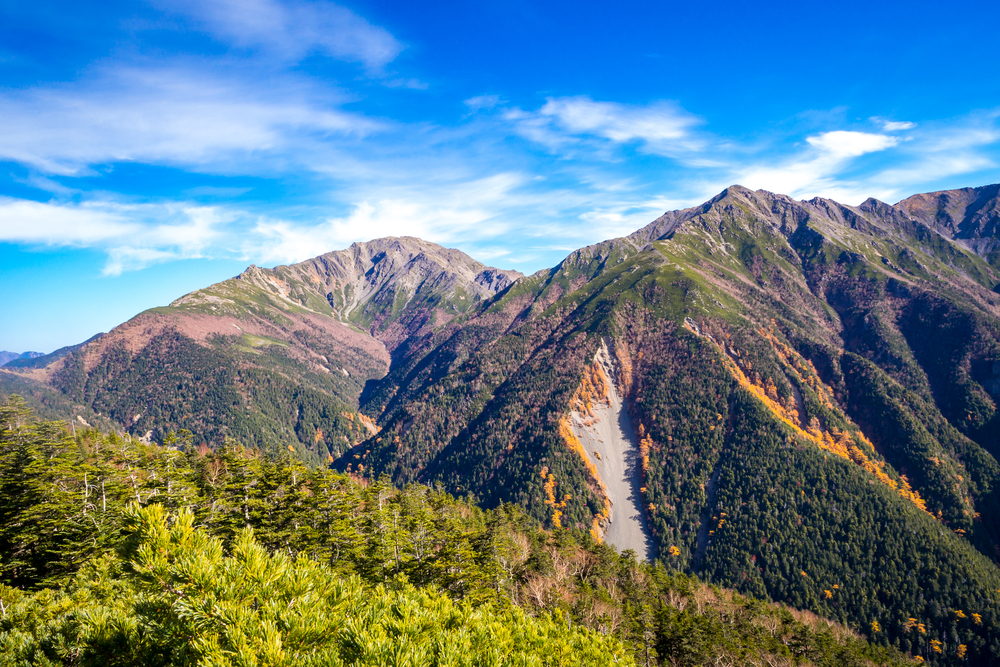
One of the most noticeable features of Japan is that it is mostly covered by mountains. In fact, the country has about 16,667 mountains, all of which make up about 80% of Japan’s landmass.
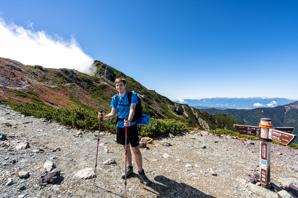
Hikers and trekkers are in for a treat as these popular mountains are well-maintained and have trails, ladders, ropes, and extensive mountain huts and lodges for camping out.
Here is some information about Japan’s 5 highest mountains so that you can add them to your climbing list and get to planning your next big trip.
Table of Contents
The Highest Mountains to Climb in Japan
Number
Mountain
Height (feet)
Height (meters)
1
Mount Fuji
12,388
3,776
2
Mount Kita
10,476
3,193
3
Mount Okuhotaka
10,466
3,190
4
Mount Aino
10,463
3,189
5
Mount Yari
10,433
3,180
1. Mount Fuji
About the mountain
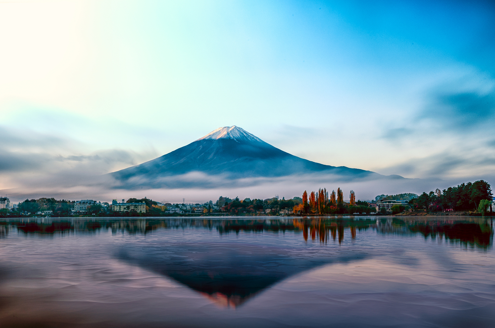
The highest mountain in Japan is Mt. Fuji, which is 3,776 meters tall or 12,388 feet. This dormant volcano is located in Honshū and on the border between Shizuoka and Yamanashi Prefectures. Its near-symmetrical snow-capped cone makes it one of Japan’s most iconic and well-known attractions. For centuries, many tourists, photographers, painters, and artists have made this mountain their subject and inspiration.
Mt. Fuji can be seen in Shizuoka Prefecture and Yamanashi Prefecture. The best view in Yamanashi Prefecture is from Yamanaka Lake and Fuji Five Lakes at the foot of the mountain. If you’re in Tokyo, you can get a glimpse of the mountain from a distance on a clear crisp day from tall buildings like hotels, Tokyo Tower, and Tokyo Metropolitan Government Buildings. Another ideal spot to view the mountain is from Hakone National Park, just two hours from Tokyo via bullet train.
Getting to the mountain
The mountain is accessible via train or bus, depending on where you’re coming from. You can get a bus from Shinjuku Expressway Bus Terminal or direct bus service from the Osaka and Kyoto stations. If you’re going via train, you’ll need to transfer to the dedicated Fuji Kyuko line and get off at Lake Kawaguchiko.
If you want to go on a direct flight to the mountain, the closest airport is Mt. Fuji Shizuoka Airport, about 50 miles from the mountain. The other closest airports are Tokyo International Airport and Narita International Airport, just three hours away from Mount Fuji.
Climbing the mountain
The mountain is open to both first-time and experienced climbers. The official climbing season is from July to September when the mountain facilities are open and the weather is suitable for climbing. If you’re going between October and June, the weather at this time can make the climb a challenge and is highly discouraged because of the extreme winds and snow.
From the foot of the mountain to the peak, you’ll find 10 stations with shops, restaurants, huts, and other mountain facilities. Hiking Mt. Fuji takes about 5–10 up and 3–4 hours down, depending on where your starting point is.
There are four “5th” stations where you can start your climb: Fujinomiya, Subashiri, Yoshida, and Gotemba. The most popular station is in Yoshida because of its convenient facilities including mountain huts and parking space availability. Aside from hiking, paragliding is also a popular activity in Mount Fuji, especially in the 5th stations.
2. Mount Kita
About the mountain
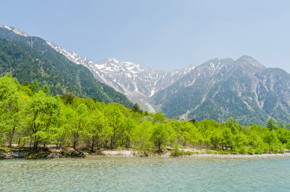
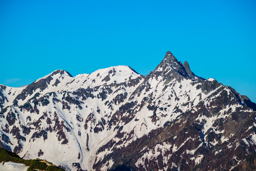
Located in Yamanashi Prefecture and within Minami Alps National Park, Mt. Kita is the second tallest non-volcanic mountain measuring at a height of 3,193 meters or 10,476 feet. It is the main peak of the Shirane Sanzan or three white peaks, which consists of Mount Kita-dake, Mount Notori-dake, and Mount Aino-dake. It is known as the leader of the Southern Alps and is also one of the 100 Famous Japanese Mountains.
In summer, the mountain is carpeted with flower fields and an abundance of plants. The mountain’s difficulty rating for hiking is between moderate and difficult since it is more rugged and off-the-beaten-path. However, it boasts the best views of Mt. Fuji from the summit, especially during golden hour.
Getting to the mountain
It is common for climbers to start from the main base in Hirogawara. You’ll need to head to Kofu City which is 90 minutes by Azusa or Kaiji limited express train from Shinjuku Station in Tokyo. You can also take the bus from Shinjuku Station to Kofu Station and take the local bus from Kofu Station to Hirogawara for a two-hour bus ride.
JR Trains from Shinjuku Station are also available, which take two and a half hours from Shinjuku Station to Takao Station and Kofu Station. If you don’t mind taking the bus overnight, take a direct all-night bus from Shinjuku to Hirogawara which is available on Friday evenings. The all-night bus is usually from 22:00 to 6:00 in the morning. However, there is no direct service going back to Shinjuku.
Climbing the mountain
It is advisable to climb the mountain in the summer months since deep snow during winter can make the climb extremely difficult. Most mountain facilities like lodges are open in the summer season as well, so you can take advantage of them to make your experience more comfortable. You can expect to hike easily with the mountain’s built-in ladders, ropes, and stairs.
If you’re climbing via the Mount Kita-dake Loop from Hirogawara, it takes about 12 hours to complete the climb and is usually done as a two-day hike. However, you can also choose to make it a three or four-day hike. The first night can be spent at the Shiraneoike-goya mountain.
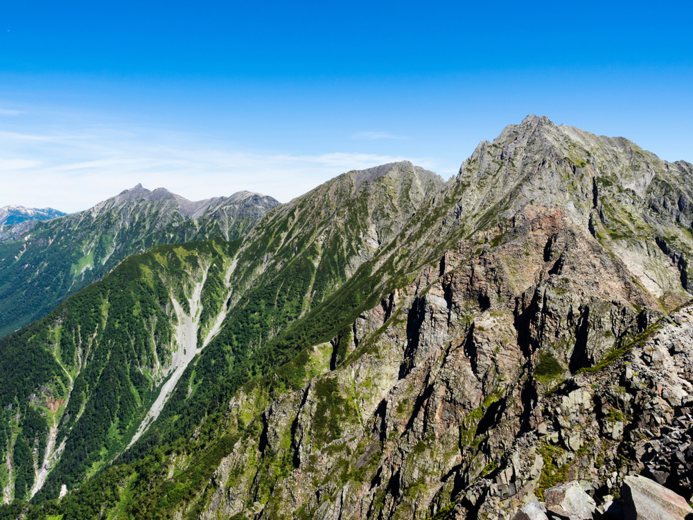
3. Mount Okuhotaka
About the mountain
Located in the Hotaka Mountain Range, Mount Okuhotaka is the third highest peak in Japan, spanning a height of 3,190 meters or 10,466 feet tall. It is part of the Hotaka Mountains which also includes the peaks of Karasawa, Kitahotaka, Maehotaka, and Nishihotaka. It can be found in Gifu and Nagano Prefectures and is known as the Leader of the Northern Alps.
This mountain is rockier compared to other mountains in Japan; thus, making it a mountain for experienced climbers only. However, it’s still a popular tourist attraction with its stunning mountain views, valleys, craters, and rivers. The first recorded person to climb the mountain is Gunji Abe who climbed in 1906.
Getting to the mountain
Reach the mountain via car or bus from Shinhotaka Onsen or Kamikōchi. If you’re going by car, the foot of the mountain has free parking spaces for hikers at the Ryokan Shinhotaka Okuhida. Once you go past the entrance of the mountain, you’ll begin the climb and be guided with available signage and maps at the lodge.
If you’re coming from Takayama Station in Gifu, take the bus going to Shinhotaka Onsen which will take more than an hour. For those coming from Matsumoto Station in Nagano, you can also take a bus from there.
Climbing the mountain
Hiking Mount Okuhotaka requires planning and having the right equipment. Keep in mind you need to have the right physical stamina and mental preparation to conquer and complete the hike. If you are a novice hiker, it’s best not to climb this mountain since it is rocky and only recommended for experienced hikers.
It will take about 14 hours to complete the hike but it can be divided into a few days since there are huts available where you can sleep and take a rest. Bear in mind that it is recommended to wear a helmet as there can be falling rocks on the mountain. You can bring your own helmet or borrow one for free from Karasawa Hutte.
One of the most popular climbing routes starts at the base of Karasawa and consists of Mount Okuhotaka, Mount Maehotaka, and the Tsuri Ridge forming a U-shaped trail. The Karasawa Cirque is a major cirque in the Hida Mountains with two major mountain huts including Karasawa Hutte and Hut of Karasawa.
4. Mount Aino
About the mountain
Rising to a height of 3,189 meters or 10,463 feet tall, Mount Aino is the fourth highest mountain in Japan and the second highest in the Akaishi Mountains. It is seen in the west of Yamanashi Prefecture and Shizuoka Prefecture. It is part of the Shirane Sanzan of the Southern Japan Alps alongside Mount Kita and Mount Notori.
A part of the mountain serves as a border of Shizuoka Prefecture. When hiking this mountain it is especially important to use caution and pay attention to areas where the trail may be unstable or be shrouded in thick fog.
Getting to the mountain
Since Mount Aino is only accessible after hiking Mount Kita-dake or Mount Senjyo-dake, you’ll need to head to the trailhead to these mountains first. Most climbers start at the trailhead of Mount Kita-dake which is in Hirogawara in Minami Alps National Park. If you’re coming from Shinjuku Station, it’ll take about four and a half hours by train and bus to reach the trailhead.
From Shinjuku Station, you can take the JR Train or highway bus to reach Kofu Station. It is recommended to take the JR Train since you can catch the first train at 5 in the morning and arrive around 12. If you’re taking the highway bus, you’ll only be able to depart at 7 in the morning and arrive at 2 in the afternoon which is already late for a day’s hike.
Climbing the mountain
If you’re coming from Hirogawara, you’ll be climbing the Shirane Sanzan in the following order: Mount Kita-dake, Mount Aino-dake, and Mount Notori-dake as there is no direct route to Mount Aino. For those coming from Narata, the hike is in reverse order starting from Mount Notori. The nearest hut from the base of the summit of Mount Nishinōtori is the Notori hut.
Between Mount Aino and Mount Kita is another great spot for a break, the Kitadake mountain cottage. Overall, the most recommended long route would last for three days and two nights. The first day of the hike can be spent on Mount Kita, the second is going to Mount Aino and Noroti, and the last day heading to Narata Onsen. After the hike, you can have a hot bat at Momonoki Onsen for ¥1,000 per adult.
5. Mount Yari
About the mountain
Situated in the south of the Hida Mountains, Mount Yuri is the fifth highest mountain with a height of 3,180 meters or 10,433 feet. It is among the 100 Famous Japanese Mountains that are located in Gifu and Nagano Prefectures. You’ll find this mountain in the Chūbu-Sangaku National Park.
The mountain is easily distinguished by its spear-shaped peak. Its name comes from yari, which means “spear” in Japanese, and its shape gave it its title of the “Matterhorn of Japan”.
With its pyramid shape, four ridges lead to the summit: Higashikama, Yarihotaka, Nishikama, and Kitakama. There are also four valleys namely Yarizawa, Hidazawa or Yaridaira, Senjōzawa, and Tenjōzawa. If you’re in the mountains, you’ll find numerous mountain huts including Hut Ōyari, Sesshō Hut, and Yarisawa Lodge.
Getting to the mountain
If you’re in Gifu Prefecture, the hike begins from the Kamikochi resort which can only be reached via shuttle bus or taxi since private cars are not allowed. A one-way shuttle bus costs about ¥1,000 whereas taking a taxi can be more than ¥4,000. For those beginning at Shinhotaka Onsen, you can go by car or bus to reach the trailhead.
Free parking spaces at the Ryokan Shinhotaka Okuhida are available at the foot of the mountain if you’re going by car. Should you decide to take the bus, head to the Takayama Station in Gifu Prefecture and hop on the bus going to Shinhotaka Onsen. The first bus departs at 7 in the morning and takes an hour and a half to reach your destination.
Climbing the mountain
Most climbers hike from Kamikochi in Nagano Prefecture following the Kamikochi Course trail. From Kamikochi to the valley near Yoko’o, the trail continues to climb reaching the Yarisawa Lodge. Throughout the hike, you’ll see dense forests, stunning rivers, and even wild monkeys.
After hiking for about five hours, you’ll spot the peak of the mountain and find another campsite called Yarigatake Sanso lodge. You’ll find ladders and chains as you go up the summit, so those with fear of heights might find this difficult. The overall hike can be done in two to four days, depending on your preference.
However, we recommend resting for a night in the mountain and continuing hiking with a nearby summit like Okuhotakadake. Upon reaching the top and viewing the sunrise, go down the summit and expect a descent of seven hours.
Before Hitting the Trails of the Highest Mountains
Should you decide to visit any of the five highest mountains in Japan, be aware of some country-specific tips before heading to the trails. For instance, always have a bear bell with you when on the trails as some areas like Hokkaido and Tokyo have bears roaming around. Another animal to watch out for is giant hornets or suzumebachi. Coming too close to the hornet’s nests can trigger them to attack passersby.
Every hiker knows the importance of preparation, especially with potential weather changes. Thus, it’s best to always be prepared for rainfall by packing a waterproof jacket. In summer, protect yourself from the rays of the sun by wearing sunscreen, a pair of sunglasses, and a hat.
The mountain is usually rocky, so bring trekking poles if needed. You don’t have to worry about food and water as these mountains have a handful of lodges for these necessities and to stay overnight. You can simply travel light with a refillable water bottle.
Although most trail routes are clearly marked with signs, it is highly recommended to have a hiking map or GPS device, especially when there’s poor visibility. If you decide to stay for the night in a mountain hut, expect to be sleeping in shared rooms. Thus, we recommend bringing earplugs to cancel out the noise while sleeping. Plus, it is best to come on the weekdays to avoid the crowd.
Best Time to Hike
Although Japan is an all-year-round destination, hiking in the mountains is best in the summer season, especially for beginners. Additionally, it depends on the prefecture you are visiting. For instance, summer in Kyoto is the best time to head to the Japanese Alps.
It may be scorching hot at the foot of the mountain but becomes cooler as you climb above 2,000 meters. The mountains are most popular to visit in July and August since the mountain huts are all open during this time and the weather is comfortable and safe. If you’re coming in April, it’s still not yet advisable to hike as the weather is still in winter mode up in the mountains.
September may not be the best time to go as it is generally considered the typhoon season. Although we don’t recommend winter hiking, it can be done by experienced hikers and with proper clothing. Winter hiking in the Japanese alps is usually for hikers preparing for Himalayan expeditions. It is dangerous to hike in the winter season due to potential avalanches and unstable snow cornices.
Choose Your Hike
Decide on the type of hike you are going for, whether you’re down for a day hike or even a multi-day traverse. Day hikes are more popular for tourists but aren’t possible for some mountains on this list.
Some mountains are difficult to hike and require a few days to climb. If you’re going for a multi-day hike, use the huts available to make your trip easier. You need at least ¥12,000 a day per person for accommodation and food if you use the huts.
For those on a budget, backpacking or camping is the way to go. Campsites usually charge a camp fee of about ¥500 to ¥1,000 per person which includes restroom facilities. Moreover, water and food are purchasable in the area.