The Caribbean Sea is full of captivating islands that offer a wide range of fauna and flora. Cuban happens to be one of these islands that offers you more life than you can imagine.
While this country is widely known for offering the best cigars, there is a lot more to it than that. You’d be surprised to find that it has rivers that have the most protected biospheres in the world.
These rivers are not only large enough to improve certain circumstances such as irrigation and reforestation, but they have endemic species that provide historic and cultural value to this rich land.
But what do you know about Cuba’s rivers? If you’re curious about what more you can learn about them, you’re not alone.
Keep on reading to find out everything you can about the 7 major rivers that you can find in Cuba.
Table of Contents
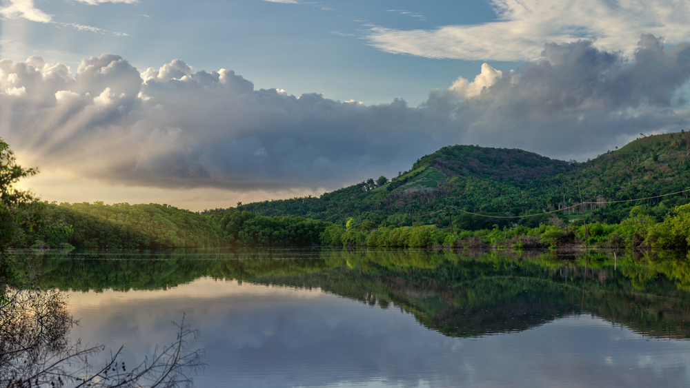
1. Cauto River
Did you know that the province of Granma has the largest river in Cuba? Not only is the Cauto River the largest at more than 200 miles, but it also sits at an estimated 1125 feet above sea level.
The source of its water comes from the ever-so-popular city of Palma Soriano.
This is a natural river that runs in an unusual south-to-north direction. As it stretches for more than 200 miles, it ends up emptying in the Gulf of Guacanayabo.
Within this specific municipality, you’ll find other rivers that aren’t as large as this one.
One of the many interesting things about the Cauto River is that it has a river basin that’s an area of nearly 6,000 square miles. There are various projects that have been headed by the Cuban government within the river’s basin.
The main thing is to fight against any contamination and droughts that have been an issue within this area.
How does the Cauto River Benefit Cuba?
The projects that are carried out within this basin are a significant part of preserving the fauna and flora of this province.
Things such as reforestation, environmental education, and the removal of pollutants are primary focus areas.
There is no denying that over the years there has been a significant decline in the flora and fauna that used to be found in this river.
According to research, by 2003 only 11% of trees were still considered to be covering the total area of the Cauto River.
This is shocking considering the fact that dating back to 1959, the Cuban government had come up with plans that were aimed at improving the status of this river and the surrounding ecosystems.
This river is the source of water for a population that exceeds a million people from the four provinces of Cuba, namely, Granma, Las Tunas, Holguin, and Santiago de Cuba.
What’s the most interesting thing about the Cauto River?
People who visit this Cuban province have used this river as a source of inspiration. In some cases, they’ve written songs and poems for it.
The beauty of the Cauto river is a marvel. The most famous poem that was written to honor this river’s magnificence was by Carlos Manuel de Cespedes.
He wrote a poem titled “Ode to the Cauto.” Moreover, the river’s name has been used as inspiration for many other things such as magazines, music groups, and radio stations.
The location of this river is very significant. For one, the territory of Granma is only limited to the North.
In addition, there are majestic mountains that provide a wide contrast to this area. There is even a national park that was declared a world natural site by UNESCO.
This province is considered one of the most historically and culturally rich heritage sites in the country.
The rich heritage of the Cauto River
This is where the Cuban national anthem was sung for the first time in history. There are other kinds of natural and exceptional phenomena that you can find in this province.
The Cuban government has declared this river to be the most prominent one that you’ll find in Cuba.
There are even celebrations that take place to honor this river and its history among the people of this beautiful country.
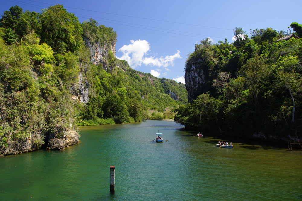
2. Tao River
Image: Wikimedia / Ralf1010
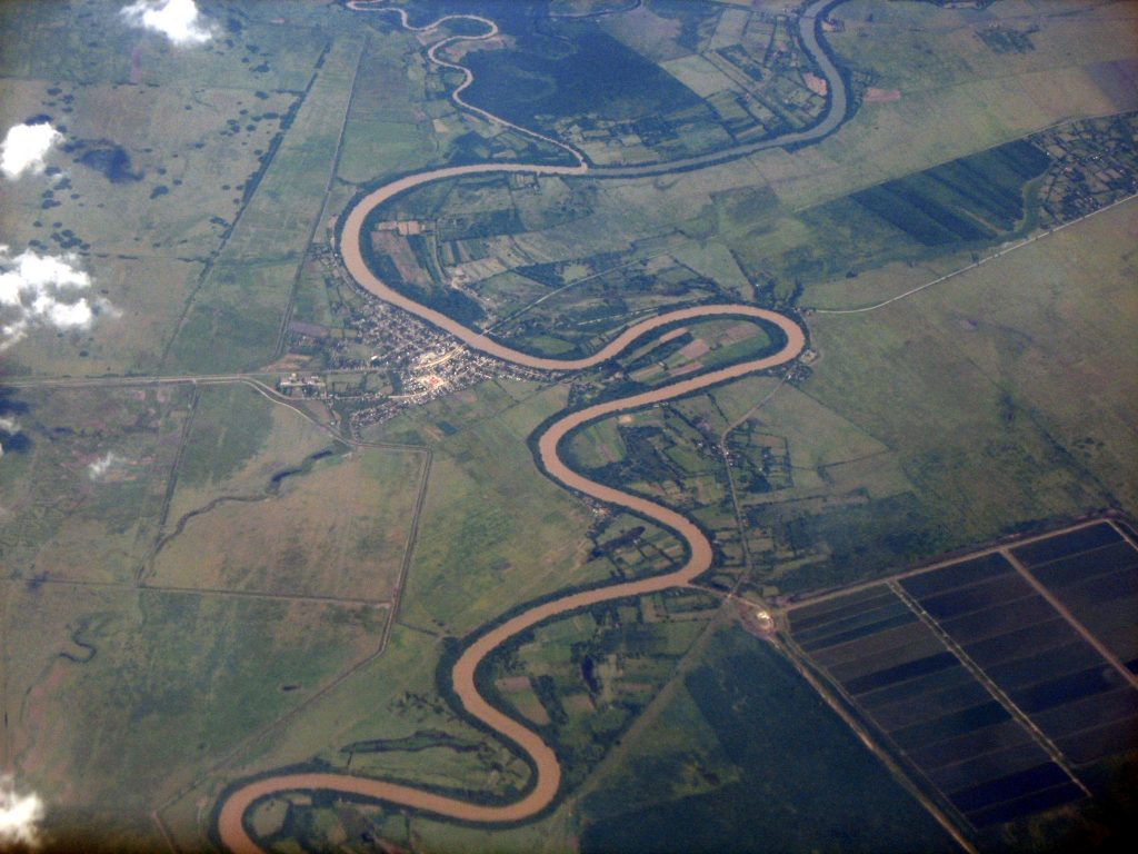
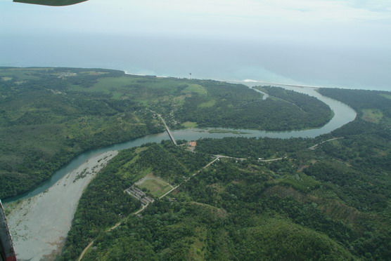
If you’re looking for one of the biggest and mightiest rivers in Cuba, then the Tao River is it. If you’ve ever heard of Guantànamo, then you have an idea of where this river is located.
However, since this river has more than 70 tributaries it crosses a number of areas. The most marked traverse area that it crosses is found within Baracoa.
The most interesting thing about the area where this river is located is that it is still considered one of the main areas where you can find forests that have a lot of rain present within the Northern Hemisphere.
The Tao River is known for its remarkable biodiversity. It has a watershed that occupies approximately 70% of the Reservation of the Biosphere.
As a result, this area is considered one of the most important regions that you can find in both the Caribbean and Cuba.
Highlighting the biological diversity of the Tao River
The main component that makes this river significant is its biodiversity. There are also various landscapes, a very popular ecosystem, and endemic fauna and flora species.
This area is known as one of the oldest refuge and species centers in the whole of Cuba.
There have always been visitors that come from all corners of the world to marvel at the natural beauty of this river and its surroundings.
In geography, it’s common for the Tao River ecosystems to be described as the jewel of the world’s conservation. The extension of the Tao River watershed is an estimated 620 square miles with a half slope that ranges around 850 feet above the ground.
Why is the Tao River a world biosphere reserve?
This area is also known for having the highest precipitation in the entire Cuban region. Its precipitation levels are usually estimated at around 2600 mm/year.
The Tao River currently stretches for about 80 miles; however, this is the most deserted region in the entire country.
With its dynamic offering of flora and fauna, there are areas where the Tao River stretches that have been declared a World Biosphere Reserve by UNESCO.
The thing about this watershed is that it has incredible flora preservation. Moreover, the endemic fauna comes in larger volumes than in any other area in the country.
For instance, you can find more than a thousand species of flowers with almost 150 types of ferns. Within the fauna, you’ll find several species of endangered birds. These birds include the national bird of Cuba, known as the Tocoroco.
It’s important not to confuse this river with the Guama River in Brazil. The Rio Guama River is located in the southern province of Pinar del Rìo.
This province has a large number of areas that are protected by UNESCO.
The two main Biosphere Reservations that you can find within this province are the Guanahacabibes Peninsula as well as some of the mountain ranges of the Sierra del Rosario Mountain Range.
These two sites have been declared World Heritage Sites. This area is home to a number of natural areas that are full of preserved fauna and flora.
Moreover, this entire area is known for its ability to cultivate premium tobacco. The river provides an ideal landscape for farmers to maintain fertile crops.
The Rio Guama River is undoubtedly the third-largest river that you’ll find in the Cuban region.
How significant is the Rio Guama River?
This river flows for an estimated 51 miles within the Guantànamo area. In fact, “Guantànamo” means that the land is between rivers – this is because the Tao River also flows across this area.
Nowadays, this river discharges its water into the El Punto dam.
However, it used to do so in the Caribbean Sea. Now, the water is used for other crucial things such as irrigation.
The Rio Guama River is found flowing along the base of the Sierra del Rosario Mountain Range.
Since Pinar del Rìo mainly focuses on the production of crops such as tobacco, coffee, and sugarcane, this river plays a vital role in ensuring that it meets its objectives.
4. Yumuri River
In the Western region of Cuba, you can find a legendary location known as the Yumuri Valley. It falls within the Matanzas province which has various protected area systems.
There are three main phenomena that characterize this three-hundred-year-old city.
You’ll find the Bellamar caves, Pan Hill, and the most beautiful River Yumuri Valley, or simply the Yumuri River. This river runs along one of the most beautiful valleys in Cuba.
It is located about 60 miles east of Havana. This river gorge is majestically formed in a wide point that’s an 80 hectare plain, and it has elevations that are up to 490 feet.
Discovering the hidden wonders of the Yumuri River Valley
Alongside the Yumuri River valley, you will find a natural landscape that is home to its most essential flora and fauna. These have cultural, historic, and endemic value within this region.
The most notable species found along this valley is the Melocactus matanzanus.
This is a type of cactus that you can’t find anywhere else in the world except for this specific area on the Cuban island.
Research suggests that the Yumuri River valley is one of the main key attributes of the geographical history of this land. It even offers a lot of information for geographers and specialists alike that wish to learn more about this area.
In addition to this, there are two rivers that flow through the Yumuri Valley.
These begin in the Pan de Matanzas area and trace a 15-mile course until they eventually converge in the Bay Area of Matanzas, a province that was founded in the 17th century. However, this area has a deeper history than this.
How old are the Yumuri Valley’s fauna and flora?
As a matter of fact, scientists have asserted that there are animal and plant species in this region that date as far back as around 30 million years ago.
Even the land that’s surrounding this river is known for its fertile and alluvial deposits. The soil, which is a black and dark-grayish color, has been hailed for ensuring that agricultural production remains ideal in this area.
There are many myths that surround the origins of the name “Yumuri.” In some myths, you’ll learn of indigenous people who would shout this name as they jumped from the top of the mountain ranges.
In other instances, you’ll know of a story about a girl who fell in love and her cry is what caused the earth to open up to create two rivers.
Yet, studies done by different researchers including renowned journalist Idalmis Lèon, say that the name is from Cuban lexicography. This suggests that the name “Yumuri” means “white river.”
But the direct translation from Spanish isn’t “white river,” it’s just a very closely related translation.
What are the main attractions of the Yumuri River Valley?
Regardless of how this name came about, it has become a perfect descriptor for this valley. And, it has brought with it many tourists who wish to see the captivating Yumuri Valley River.
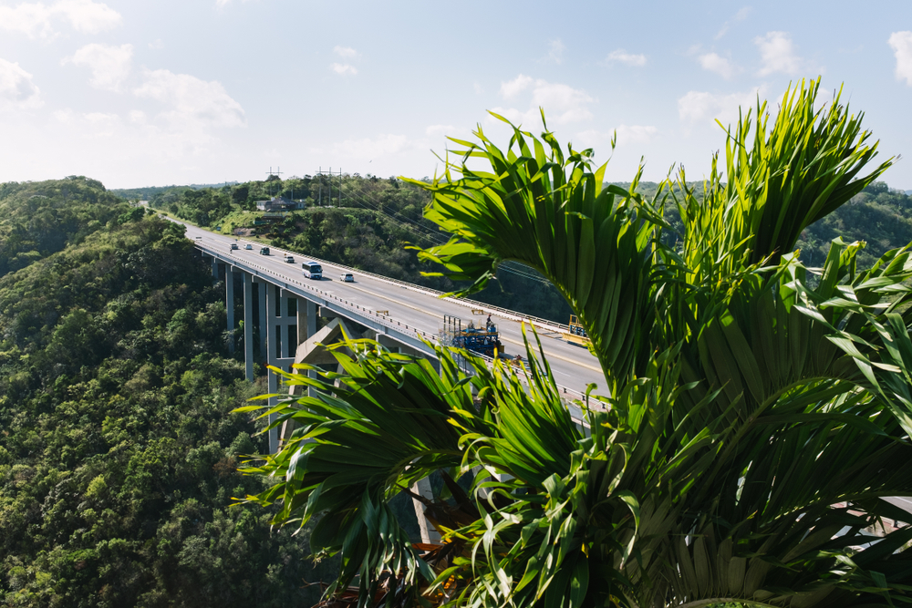
If you happen to tour the plains of this valley, just remember that you have two rivers to see. The Bacunayagua river can also be observed from the famously known Bacunayagua Bridge.
Here, you can find an overpass that is highly recommended as one of the main wonders of civil engineering in Cuba.
If you ever feel like hiking in this region, then the Yumuri canyon should be an ideal option for you. It is a popular excursion for many tourists that come into this area.
You’ll find the Belete Waterfalls, which are 98 feet high. This piece of land is a total of 911 hectares and offers opportunities for boat rides, lookout points, and even emerald pools for bathing.
Going for a hiking trip in the Yumuri River area
There are different hiking options that offer you a perfect balance of nature’s ambiance. There are various natural fauna and flora species that you can find and clear waters to help you cool down.
So far, the rainforests remain pretty untouched.
At the mouth of the Yumuri Canyon, you can find a bridge that offers you incredible views of the river. Not too far from this point, there’s the famous El Mirador de Yumurí lookout point.
From here, you can watch various species of birds and butterflies.
Or you can go on a mid-length hike on the narrow trail of the Yumuri river shore. This is where you can get to fully experience the biodiversity of the fauna and flora of the Yumuri River valley.
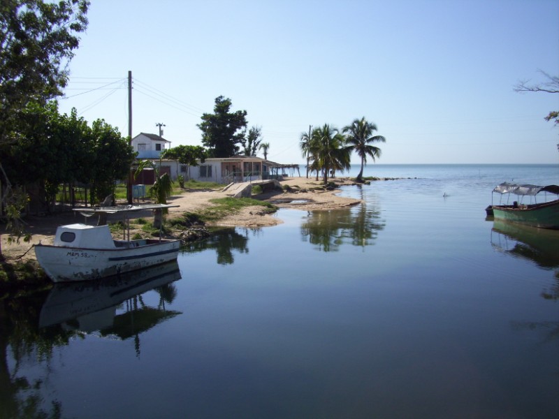
5. Rio Almendares River
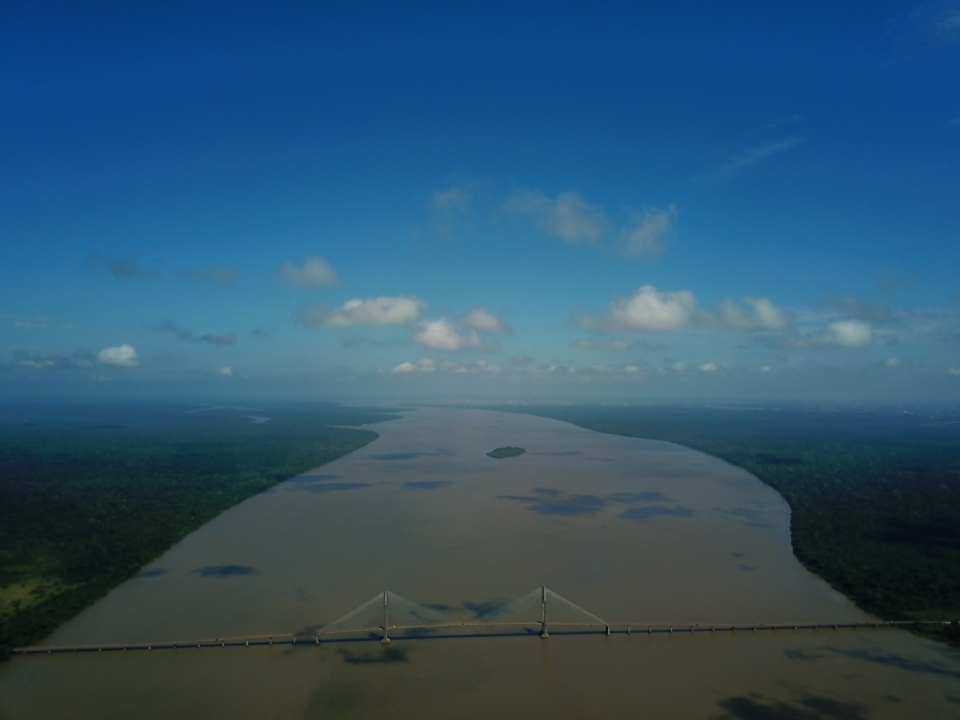
This is the fifth-largest river in Cuba. It’s ideally located in the province of Havana and empties into the fine waters of the Bahià de la Habana.
This river is considered one of the most important urban rivers that you can find in this province.
There are a lot of communities in Havana that depend on this river.
According to a report that was conducted in 2003, there are many issues such as pollution, deforestation, overpopulation, and lack of environmental management that have contributed to the degradation of this river.
The length of this river stretches for 28 miles along the urban city of Havana.
While the quality of this river is said to be poor due to the above-mentioned factors, it’s still the main water supplier of Havana.
A part of this river forms part of Almendares Park, located within a few kilometers of the ocean. There are various industrial plants that rely on this river to maintain their production processes.
What’s the importance of rehabilitating the Rio Almendares River?
Fortunately, the Havana municipality has started projects that are aimed toward the rehabilitation of this river and Almendares Park.
One of the ways that this should be achieved is by improving the pollution along Havana Bay.
There should be better irrigation, cleaner water available for everyone, and fewer health hazards. As a result, this should help to propel the Havana Bay municipality towards improved economic activity.
This river can be effectively used to help with the alleviation of poverty within the vast majority of communities that are found along the city and riverbanks.
6. Mayabeque River
You’d be surprised to find that this river was first mentioned 17 years after the discovery of Cuba. This river dates back to the 1500s. Research suggests that it is found in a village that’s believed to be the original Havana.
In the former province of Havana, this was considered the largest river. Nowadays, it has become the main river that you find in the Mayabeque province. This is where it flows from north to south.
On its banks, you can find the historic city of Güines. A lot of tourists come to this city to explore its famous cold bath waters. If you happen to visit this city in summer, you’ll be sure to find yourself on the shores of Mayabeque beach.
What is the Mayabeque River Known For?
The banks of the Mayabeque river are known for their rich vegetation. There are plenty of trees and shrubs of various types of species that grow around here.
The most common type of plants that you’ll find along this river’s bank are mangroves that are identified by their red color.
The Mayabeque river is considered one of the largest rivers that you’ll find in western Cuba. In fact, it’s said to be the largest river that forms part of the southwestern watershed of Cuba.
Fortunately, you can still navigate through its last 3.1 miles with a boat if you want to see more of this river.
However, the Mayabeque river isn’t the only thing that you’ll get to see when you take the time to visit this Cuban province. For instance, you can spend some time wandering about the area’s various rum distilleries.
Or you can take your time to look at fresh produce that includes citrus fruits, sugar cane, snuff, and wine grapes.
How does the Mayabeque River boost tourism?
Travel in this province is very popular. A lot of tourists come from far to enjoy the sandy beaches and resorts that you can find alongside the shore of Mayabeque beach and Playa Jibacoa beach.
There’s no denying that the famous waters of the Mayabeque River have helped to better economic activity in this province.
In fact, there are people who travel from all over the world to marvel at the fruits of the lush vegetation that this river is responsible for. In fact, this province exports most of its produce to increase economic growth in Cuba.
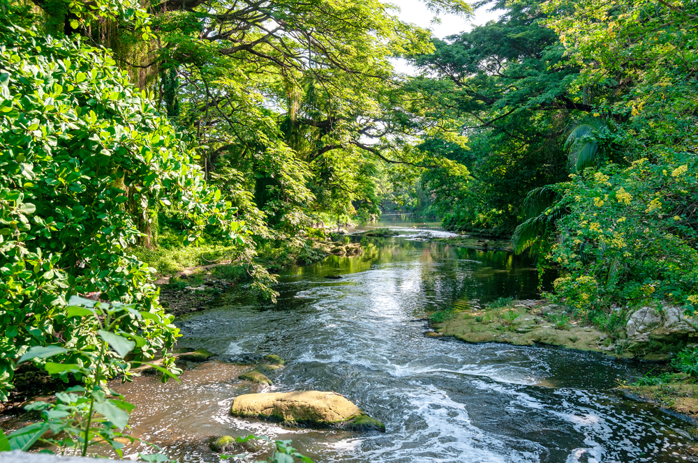
7. Rio Cuyaguateje
If you’re looking for a river that’s still mainly untouched, then the Rio Cuyaguateje River is your best bet. This river is located in the Pinar del Rìo province that’s found in the western part of Cuba.
Most of its land area is protected by UNESCO and has been declared a World Heritage Site. The Rio Cuyaguateje River is home to some of the most historically and culturally significant flora and fauna in the country.
Amongst these, it’s common for you to find oxen grazing along its riverbank.
Moreover, you can enjoy going fishing on this river. Expect to catch very large fish, as it still remains one of the rivers that haven’t been overly used by the local population.
Frequently Asked Questions
Does Cuba have a sufficient clean water supply?
Over the years, the water problems that Cuba has been facing have left much to be desired.
While this country still has abundant rivers flowing across it, it’s estimated that no more than 80% of people have clean water that runs from their taps.
In fact, it’s very common to find tourists drinking from water bottles while the locals spend more time boiling their water than drinking it.
Where does Cuba get its fresh water from?
It wasn’t until Cuba faced water shortages in 2017 that the rest of the world got to see how much trouble this water-rich island really was in.
Thankfully, various organizations such as the United Nations stepped in to assist. Currently, there are different kinds of rapid water facilities that ensure that freshwater scarcity is rectified.
Can the rivers in Cuba alleviate the water crisis?
That depends. If the government can work efficiently to rehabilitate the rivers that are endangered due to pollution, then some level of alleviation should be achieved.
This should help to come up with better treatment systems, and permanent solutions for this water-scarce country.
In summary, if you ever happen to visit Cuba, you should make time to go on a boat ride or two. In some provinces in this country, you can find more than one river at a time.
But there’s more to this island than the rivers that it has.
You can find majestic waterfalls, cultivated land, and even mountain ranges that may change your mind about hiking if you’re not a fan.
These seven large rivers also have fascinating flora and fauna.
However, there are still conservation issues that should be addressed to ensure that all of these large rivers are adequately maintained.