With around 25,000 miles of flowing water, the United States is in the top five countries in the world for longest waterways.
But what’s even more impressive is how many rivers – from massive routes of watercraft transit to small, winding passes – there are.
Depending on which data set you’re looking at, more than 250,000 individual rivers flow around the United States, many of them later connecting in larger bodies of water.
There’s a lot of variation in a river’s size, but it’s the widest rivers that tend to draw attention for human use.
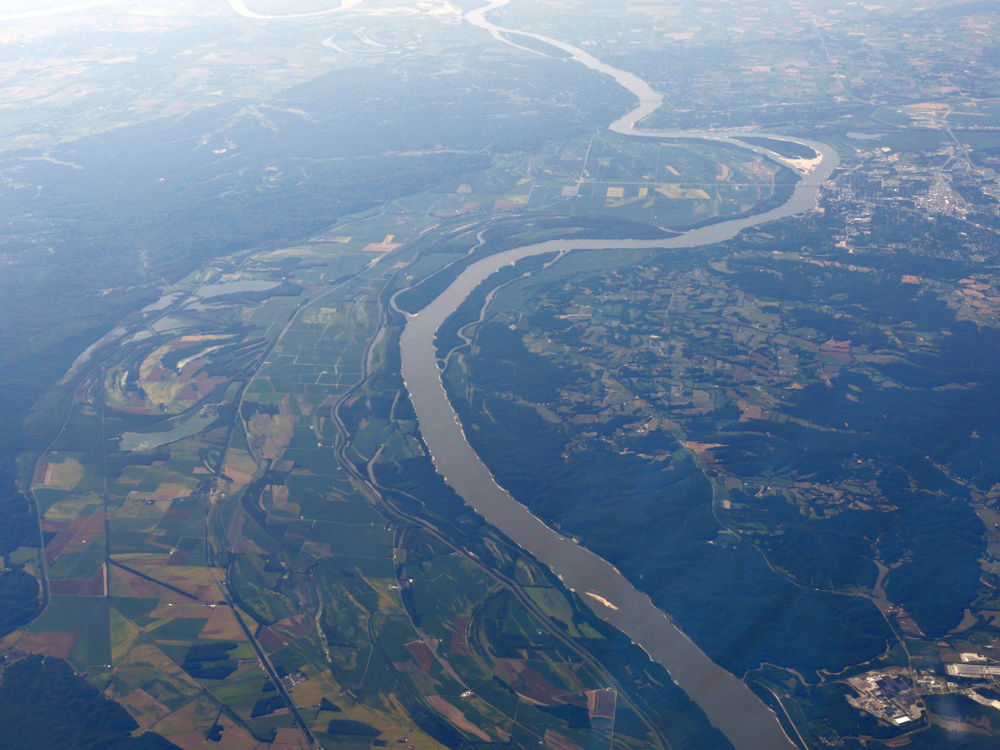
In the United States, the widest river is easily the Mississippi River. Throughout the nation’s history, the “mighty Mississippi” has become both a major natural landmark and an important channel for trade and transportation.
Table of Contents
What is the widest part of the Mississippi River?
The Mississippi River flows from north to south. While most people in the southern United States know it as this huge, wide river, that’s not quite the case up North.
In fact, the Mississippi starts as a very skinny river no more than 20 feet wide.
The widest part of the Mississippi River is where it runs through Lake Winnibigoshish near Bena, MN where it spans more than 11 miles wide (that’s over 58,080 feet wide!)
But that’s not looking at the river’s many navigable areas.
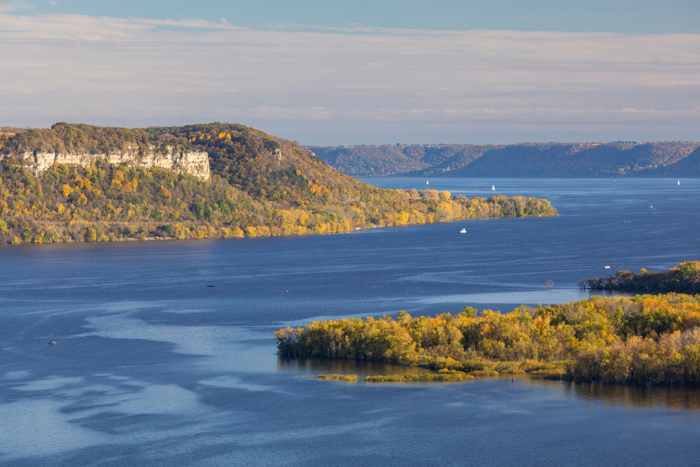
When it comes to safe passages for watercraft, the widest section of the Mississippi River is at Lake Pepin, which sits right on the border between Wisconsin and Minnesota.
Here, the river spans about two miles wide (10,560 feet). For comparison, a river body is generally considered navigable if it stays an average of just 30 feet across in width.
How long is the Mississippi River?
The Mississippi River starts way up north in Minnesota, at a small glacial lake called Lake Itasca. The lake is notably long and skinny, taking on the appearance of a wide river itself.
The Mississippi runs for 2,340 miles south and ends in the Gulf of Mexico. While many people often confuse the Mississippi for being America’s longest river, that’s actually not the case.
The Missouri River just barely edges it out, flowing for 2,341 miles.
Both rivers, however, have a clear lead over the rest of the rivers in the country – the next longest rivers are the Yukon at 1,982 miles and the Rio Grande at 1,885 miles in length.
Which states does the Mississippi River run through?
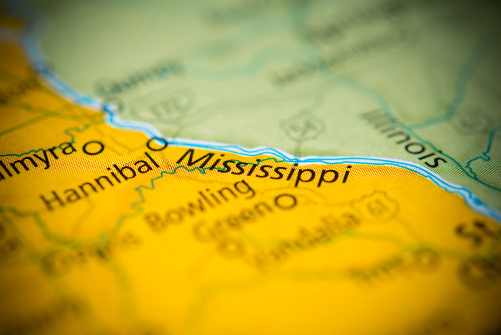
The Mississippi River flows through an impressive 10 states running north to south in the U.S. Starting in Minnesota, the river goes through Wisconsin, Iowa, Illinois, Missouri, Kentucky, Tennessee, Arkansas, Mississippi, and Louisiana.
Major cities along the Mississippi include the Twin Cities (Minneapolis and St. Paul), Memphis, St. Louis, La Crosse, Baton Rouge, and New Orleans.
It’s worth noting, however, that the river’s span goes far beyond the states mentioned, thanks to various tributaries and runoffs.
Based on the length and flow volume, the most significant feeds into the Mississippi River come from the Arkansas, Allegheny, Missouri, Ohio, Illinois, Wabash, and Red Rivers.
When looking at all of the Mississippi’s water sources, however, its reach stems from as far west as Idaho, as far north as Canada, and as far east as Pennsylvania and New York.
What is the Mississippi River used for today?
The Mississippi is, first and foremost, a major daily water source for 62 different cities, with filtration and treatment plants located almost along its entirety of populated areas.
The Mississippi is also an important shipping route in the U.S., with the highest levels of ship and boat traffic concentrated around St. Louis and New Orleans.
Recreation is a major use of the Mississippi as well. In addition to swimming and hiking spots along the river, it is a popular fishing destination.
To date, over 375 different species of fish have been discovered inhabiting the Mississippi basin, a number that far exceeds the average fish diversity discovered in other temperature region rivers of the world.
How has the Mississippi River been recognized in pop culture?
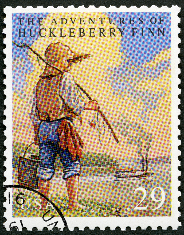
Most Americans have read or heard of Mark Twain’s The Adventures of Huckleberry Finn, in which a young Huck Finn rafts down the river for days with Jim, a man fleeing slavery.
Starting in Missouri, the two characters end up passing through Illinois, Kentucky, and Arkansas on the river.
But what many people don’t know is that the book was inspired by Twain’s own experiences working on the river as a former steamboat operator.
In addition to its literary importance, the Mississippi has inspired numerous other works. One of the most famous is “Old Man River,” a song by Oscar Hammerstein II.
The nostalgic lyrics pit the everyday struggles of Americans against the nonstop, seemingly indifferent flow of the river.
It’s also worth noting that the Mississippi’s Lake Pepin region is where the sport of water skiing was invented. In 1922, Ralph Samuelson “aquaplaned” for miles across the water, and the rest is history.
Are there tours available on the Mississippi River?
Those who want to go experience the might of the Mississippi first-hand are able to hop on a number of river cruises and riverbank-side tours.
Though the majority are concentrated in and between Memphis, Tennessee; and New Orleans, Louisiana, there are some that run as far north as St. Paul and Minneapolis, Minnesota.
At least one river tour starts on the Ohio River in Cincinnati and runs down to connect with the Mississippi.
Tour-seekers also have the option of doing day trips or riding on the river for weeks.
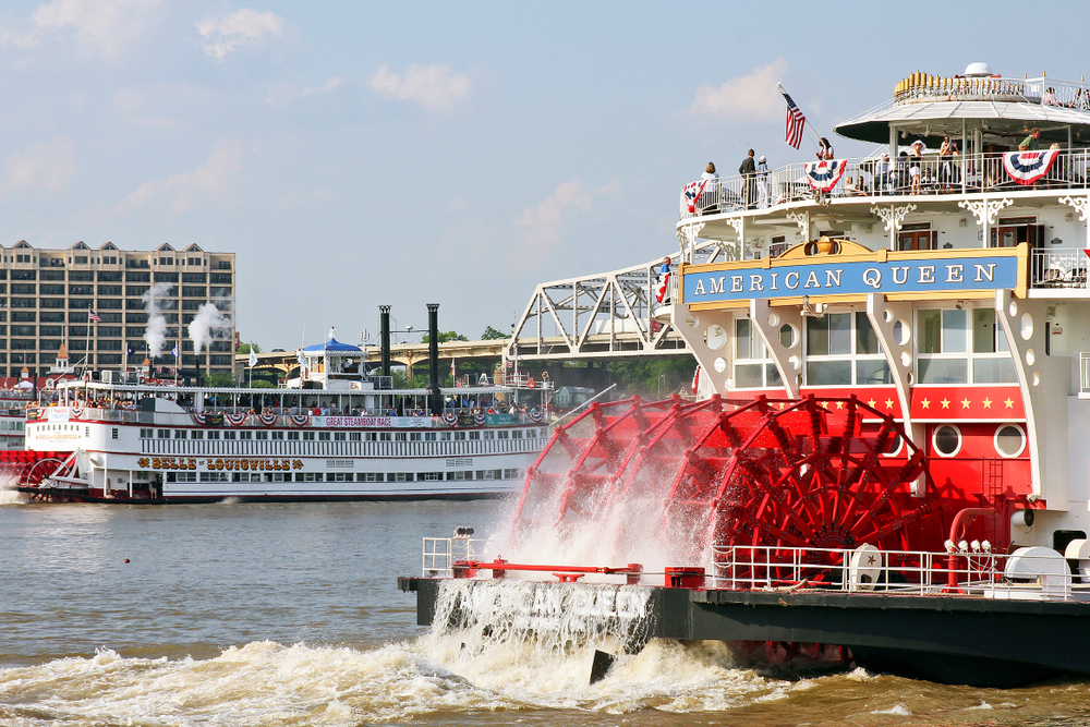
For example, the American Queen cruise boat offers tours that last up to 14 nights on the river, running almost the entirety of the Mississippi’s navigable portions from Minnesota to Louisiana.
It’s also worth noting that there are seven national parks situated alongside the river, which are popular tourist destinations in their own right.
What is the second-widest river in the United States?
The widest rivers in the United States tend to fluctuate, dependent on season and rainfall.
However, it’s the Missouri River that is often referred to as the country’s second-widest river, with a maximum width that can span upwards of 10 miles wide.
The Missouri’s status as the second-widest river in the U.S. can be a bit confusing, and not just because of seasonal changes.
It is a tributary flowing into the Mississippi, and therefore it is often considered part of the Mississippi.
With a width of six miles at its widest point and an average width of three miles throughout, the Neuse River is another strong contender for the nation’s second-widest river.
The Neuse is also considered one of the oldest continuously flowing rivers in the United States and is contained entirely within the state of North Carolina.
How does the Mississippi River stack up to other rivers around the world?
As massive as the Mississippi is for the United States, it pales in comparison to some other rivers around the world.
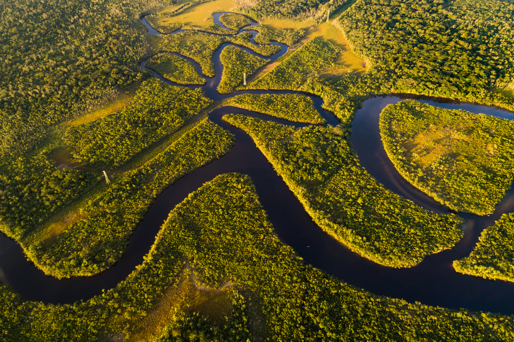
For example, the Amazon River in South America is often considered the widest river on the planet, with its widest point averaging 11 miles wide during the dry season and a whopping 30 miles wide during the wet season.
The Amazon is also the largest river when measuring the volume of water, with the Mississippi only carrying about 8% of the Amazon’s flow.
Also in South America is another impressively wide body of water, the Río de la Plata, running between Uruguay and Argentina into the Atlantic Ocean.
Though often regarded as an estuary or small gulf, many consider it a river. If referred to as such, the Río de la Plata actually takes the crown for the widest river in the world, with a maximum span of 140 miles at its mouth.