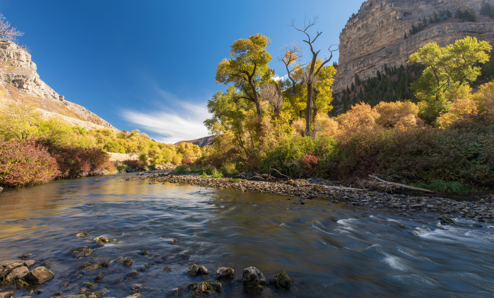
A river will move from its original point all the way to the mouth where it will deposit its water. Yet, there are many changes that occur during this process.
These characteristic changes of any river can impact various things.
For instance, the gradient or the slope of its channel that the river maintains as it travels into the base of its mouth. It’s essential for you to know how to calculate the gradient of a river.
Knowing how to do so will show you the rate of change that the river has gone through as a result of different variables. Keep on reading to learn more.
There is a simple calculation that you should follow to determine the gradient of any river that you wish to calculate. To find out what the gradient of any river is, you should know what the vertical difference in elevation is.
Once you have this, you should find out what the horizontal distance of your river is. Then, you can simply divide your vertical elevation by the horizontal distance.
Table of Contents
What is the gradient of a river?
If you’re trying to calculate the gradient of a river, it’s important for you to know what it is. According to geography, a gradient of a river refers to the slope of its channel.
In other terms, this is known as the rise over run.
If you’ve dealt with topographical maps before, then you’ll know that it also refers to the vertical drop of any river that runs horizontally.
It’s essential for you to know how to calculate the elevation and the horizontal distance to find the accurate value of your gradient.
Generally, the gradient will tend to be higher where the river starts, but it will significantly decrease at the mouth of the river.
The mouth of the river is where it changes its course as it will empty into a different type of water source, which is commonly the ocean. Two important factors come into play.
How to determine the gradient of a river
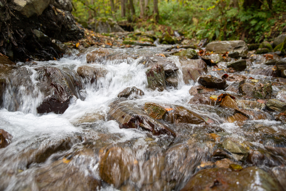
The flow of the river is measured by its discharge at any given location and time. The volume of the water that passes through a particular point is also measured.
The discharge and volume measurements are often displayed in cubic feet per second units. To determine the gradient, you’ll need to do is to multiply the width by the depth of the river’s channel.
The further downstream that you go, the more the discharge increases. It is important to note that there are tributaries that will join the main river channel to add more water to it.
What factors should you consider when calculating the gradient of a river?
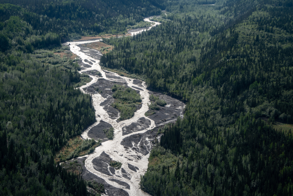
Every river carries an amount of sediment as it flows. This load will depend on the size of the river. Moreover, it will change from the origin of the river all the way to its mouth.
There are other tributaries that also carry their own loads downstream.
This means that the main river will combine with sediment loads from these tributaries. By the time it reaches the base level, it will deposit all of this sediment load.
However, carrying all of this sediment downstream isn’t as easy as it may look. A river may not be able to support this heavy load. If that’s the case, this is known as an overloaded river.
1. The sediment load effect
When a river is overloaded with sediment loads, it can create braided streams on. They’re called this because these streams typically form with a network of intersecting river channels that look similar to braided hair.
These streams are usually filled with gravel bars and sand.
Braided streams are commonly found in arid or semi-arid areas where erosion rates still remain high. On the other hand, it is quite rare to find straight streams.
Here, a linear zone of weakness created by underlying rocks influences the river to remain almost straight. But they can also be man-made in an effort to help with flood control.
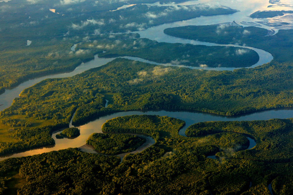
It’s also crucial to note that rivers can also meander. This is when they form an S-shaped curve. These types of rivers carry the fastest moving water that travels from an outside bend to another outside bend.
As a result, they have greater turbulence and velocity, and this can lead to a lot more erosion that takes place on this outside bend.
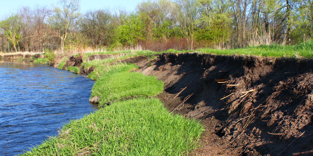
2. How erosion changes things
Any erosion that takes place outside the river bend forms a feature that’s called a cut bank. The only thing that offsets this erosion is the deposition that you find on the opposite bank of the river.
This is where you’ll find that there is slower moving water that has allowed the sediment load to settle and create deposits that are known as point bars.
Sometimes, it can be very difficult to determine if a river will have a horizontal distance or not. A meandering river can become very complicated when it cuts off the meander.
When this phenomenon takes place, the meander that was cut off will form a crescent-shaped body of water that’s called an ox-bow lake.
Characteristics of a river that affect the gradient calculation
Did you know that rivers aren’t considered living? Even though this is the case, they will still go through various characteristic changes as time goes by.
Additionally, these characteristic changes can be influenced by the change in their surrounding landscape.
The main goal of any river is to reach its base level. This is the elevation level that you need to know before you can calculate your gradient.
Plus, it helps you to know the level when the river stream can no longer erode its alluvial.
This is where most of the changes that a river undergoes will occur. There are various stages that it will go through while trying its best to reach its base-level goal.
These are stages that are concerned with the cycle of stream erosion.
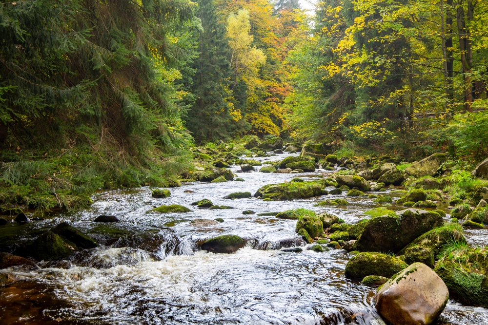
1. Early Stage (Youthful)
This is the first stage that a river will undergo. This stage happens when the river stream is vertically eroding or down cutting its channel.
This is very significant because what happens is that sediment load is picked up from the bottom of its channel.
This causes the river’s elevation to decrease. Moreover, the river will form a V-shaped channel while the land surface remains above sea level.
2. Middle Stage (Mature)
This is the stage where two different types of erosion can be seen. There is vertical and lateral erosion that’s commonly known as downcutting and meandering, respectively.
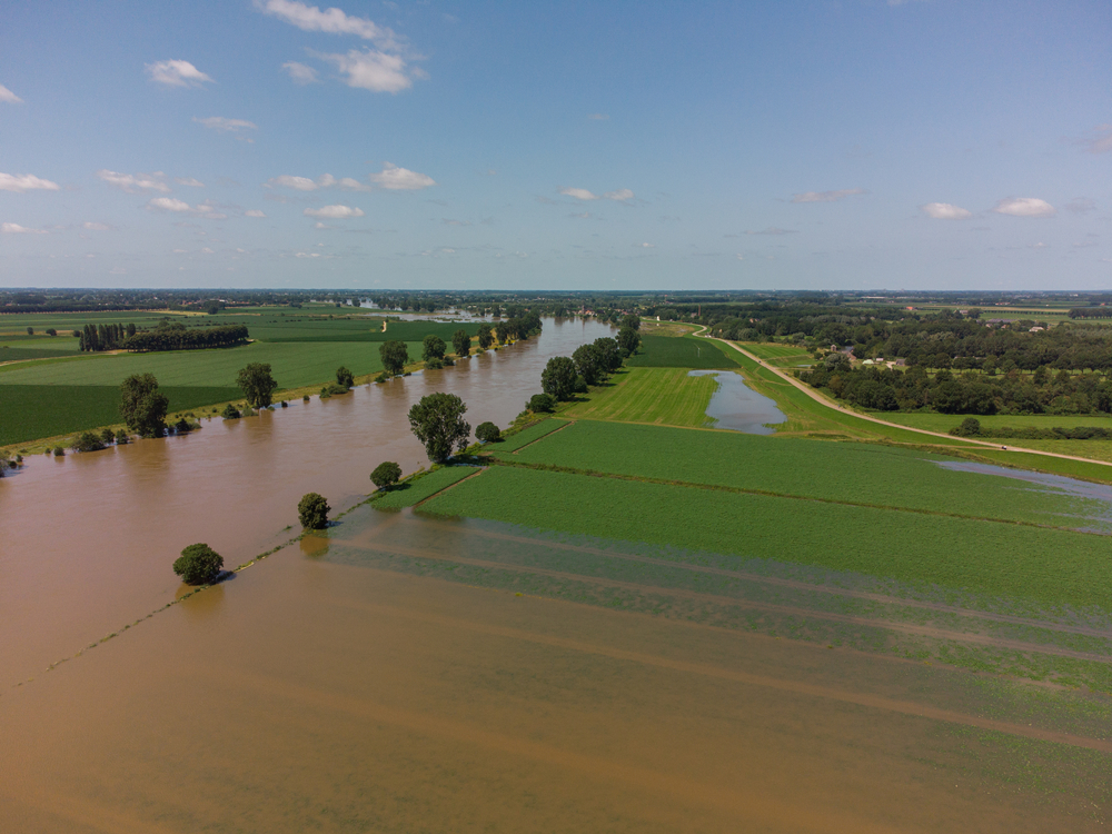
Instead of having a river that maintains a horizontal distance as it flows, it will begin to form a floodplain and the land slope will become sloped.
This is when a river is prone to flooding. As you can tell, this can affect the gradient immensely or change it from what it was initially.
3. Late Stage (Old Age)
With every cycle in life, an ending has to happen, and this is evident in the flow of most rivers. When a river reaches this stage, it will be more focused on lateral erosion.
An interruption can take place in this stage of the cycle that can create very complicated meanders as well as ox-bow lakes.
Other factors that can affect this stage include the sea level dropping, which ultimately drops the base level, or the uplifting of the area, due to the formation of mountains.
This can cause the river to be cut down all over again, or it can be rejuvenated.