Clouds are ice crystals or water drops suspended in the sky. Clouds form when the air cools and water vapor condenses into liquid form.
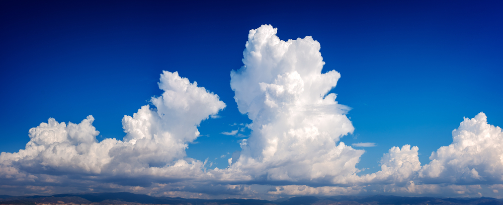
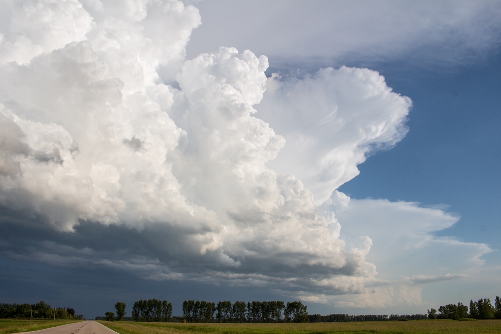
The biggest type of cloud is the cumulonimbus, the towering vertical cloud responsible for thunder, lightning, and hail.
Sometimes called thunderheads, these large clouds form when powerful air currents push water vapor upward.
Keep reading to learn more about the largest clouds and different cloud types.
Table of Contents
What are cumulonimbus clouds?
Cumulonimbus clouds are tall storm clouds that bring thunder, lightning, and hail thanks to strong upward currents.
These clouds are common with cold fronts but may form in their own clusters, too.
You can tell cumulonimbus clouds apart from others by their sheer size, as they are very tall and tower through the sky, appearing quite ominous at times, particularly on a stormy day.
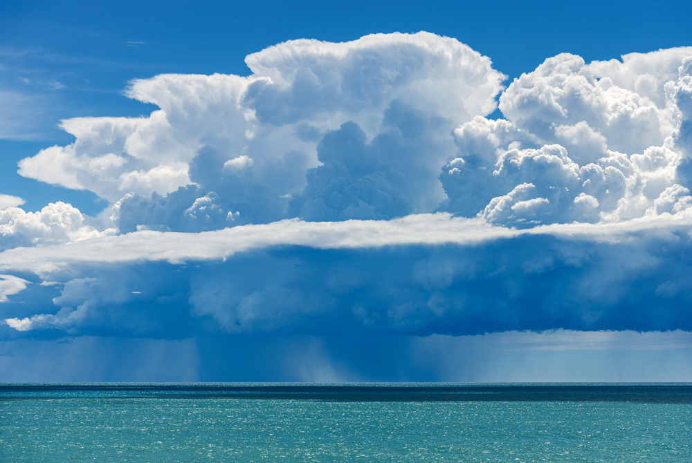
Their typical altitude ranges from 2,000 to 45,000 ft., which is much more than other clouds.
Cumulonimbus clouds are much more common in tropical and temperate regions than at the north or south poles.
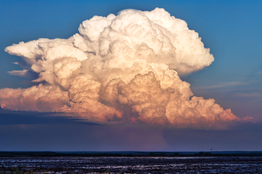
Wherever these clouds are, heavy downpours may follow, as the top part of the cloud has ice crystals and the rest contains liquid water.
Why are cumulonimbus clouds so big?
There are ten main types of clouds, split into low, middle, and high clouds depending on where they appear in the sky.
Only two of these clouds transcend more than one level, and cumulonimbus clouds are the only kind to reach all three.
When thunderstorms are forecast, it’s not uncommon to see cumulonimbus clouds very low to the ground, around 2,000 ft., and then they stretch upward into the sky, surpassing 40,000 ft. in many cases.
Cumulonimbus clouds are created through convection as they grow out of small cumulus clouds in warm conditions.
Warm updrafts push the air up as these clouds spread out in the sky, getting taller until they eventually have the same energy level as ten atomic bombs.
What causes cumulonimbus clouds?
Cumulonimbus clouds are known for big rain, wind, and hailstorms, and they are formed by thermal winds forced upward by warm air.
These heavy, dense clouds are prevalent in the American South and Midwest, home to Tornado Alley where big thunder clouds bring deadly storms.
There are three key conditions needed for cumulonimbus clouds to form, including:
Consistent supply of moist warm air, rising at 25–70mph
Increased tropospheric winds which give cumulonimbus clouds their height
Unstable atmosphere without temperature inversions
There are three stages of cumulonimbus cloud formation, starting with the cumulus stage as condensation builds up inside the cloud’s base.
Next is the mature stage, when the clouds produce a thunderstorm or mix with others to create a supercell.
Finally, there’s the dissipating stage as the clouds begin to break up, usually around 25–30 minutes after the mature stage.
Do cumulonimbus clouds cause rain?
Cumulonimbus clouds cause heavy rain and thunderstorms across the globe, so if you see these tall, towering thunderclouds, you’ll definitely want to grab an umbrella.
For cumulonimbus clouds and all clouds in general, water builds up in larger droplets, eventually falling to the ground as rain or snowflakes in colder air.
There may be sleet or freezing rain when the droplets melt during the fall to the ground, only to get colder as they hit the surface.
You will often see hail with cumulonimbus clouds during severe weather events. Hail forms as air currents move rain and snow throughout the atmosphere, with water turning into ice as it gets colder.
The ice chunks continue to grow in size until they eventually fall out of the sky and hit the ground as potentially damaging hail.
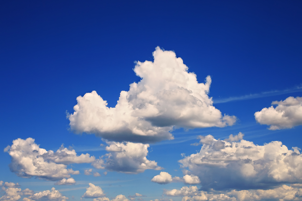
What are cumulus clouds?
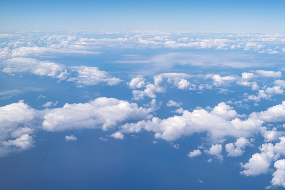
While big cumulonimbus clouds cause rain, thunder, and lightning, large cumulus clouds are found in fair-weather skies.
When you look up on a nice day and see white, fluffy clouds, you’re most likely looking at cumulus clouds, which are low to the ground near 2,000 to 3,000 ft.
Cumulus clouds are found around the world, apart from Antarctica, where the air is too cold.
They don’t really cause noticeable precipitation, other than the occasional brief shower caused by congestus cloud buildup when cumulus clouds are very tall and narrow.
Thermal convection currents are created during sunny weather as the sun warms up the ground, leading to cumulus clouds with their distinctive puff.
Cumulus clouds are split into three types: humilis, mediocris, and congestus. Humilis clouds are wide and short, while mediocris clouds are similar in height and width.
How do clouds form?
Water droplets in the atmosphere are responsible for cloud formation, as water consistently evaporates from the ground up.
There is always water vapor in the sky, but it remains invisible until the air cools down and condenses into liquid form.
The air is then saturated with water vapor, allowing clouds to form.
Clouds only form in cool air, and water condensation may occur around sea salt, ice, or dust in the atmosphere.
Conditions such as wind and temperature play a key role in what type of clouds form and how they appear in the sky.
Cumulus and cumulonimbus clouds form as warm air rises from the Earth’s surface to turn water vapor into liquid.
Other clouds like stratus and lenticular are formed when the wind hits the side of mountains and pushes upward.
Low-pressure areas and weather fronts also cause air to rise and clouds to form.
Do weather fronts cause clouds?
Weather fronts occur when two large air masses collide near the earth’s surface and force air currents up.
With varying temperatures and humidity levels in each air mass, the conditions are right for weather fronts to create clouds, particularly those with precipitation.
These transition zones often lead to severe weather, such as heavy rain or wind as seen in cumulonimbus clouds.
With a warm weather front, a mass of hot air slides over a pocket of cold air, pushing the warm air up to form low status, altocumulus, and high cirrus clouds.
Larger cumulonimbus and nimbostratus clouds often result from warm fronts, too.
Similarly, cold fronts can form cumulonimbus clouds and associated thunderstorms, as well as stratus and stratocumulus clouds.
When a heavy mass of cold air pushes warm air up, white, fluffy cumulus clouds appear, too.
What are the smallest clouds?
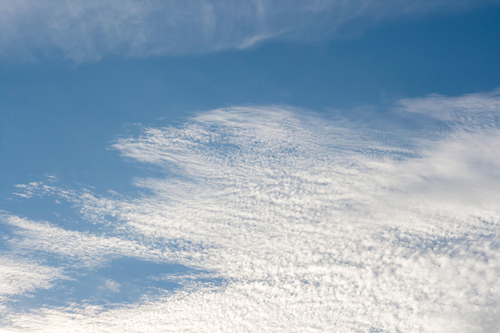
Cumulonimbus clouds are the largest, while cirrus and cirrocumulus are the smallest. Both are quite light and wispy, appearing high in the sky and visible from airplanes around 20,000–40,000 feet.
Many people think cirrus clouds resemble silky tufts of hair, as they appear light and delicate, the total opposite of towering thunderclouds.
These high-level clouds are mainly made of ice crystals, giving them their white, steaky look, similar to a jet streak.
Cirrus clouds are more feathery than cirrostratus clouds, which may appear slightly thicker.
These small clouds typically form when dry, warm air rises, causing water vapor to condense around tiny dust particles.
As the smallest and highest clouds in the atmosphere, cirrus and cirrocumulus don’t lead to ground-level precipitation and are instead known for nice weather on a blue-sky day.
Just keep in mind that the rise in air masses and currents often signals a change in the weather, so if there are cirrus clouds, there may be a shift coming in the next few days.