What City Is the Geographical Center of North America?
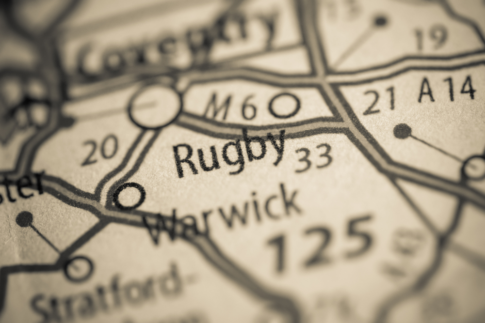
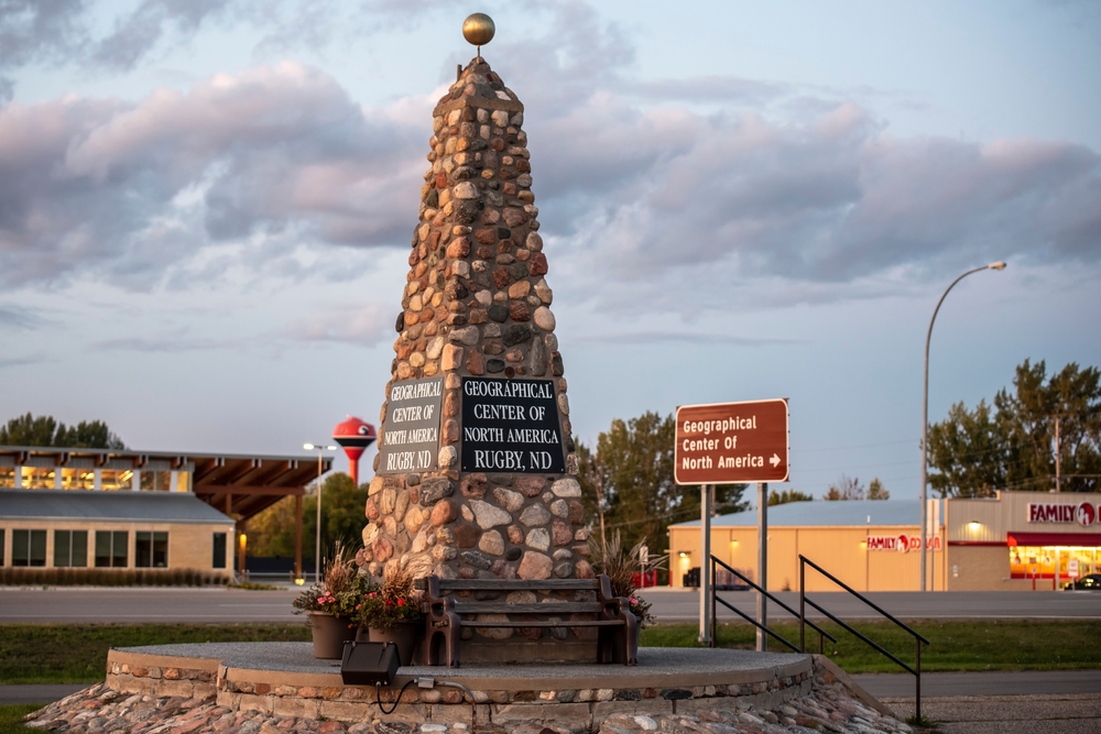
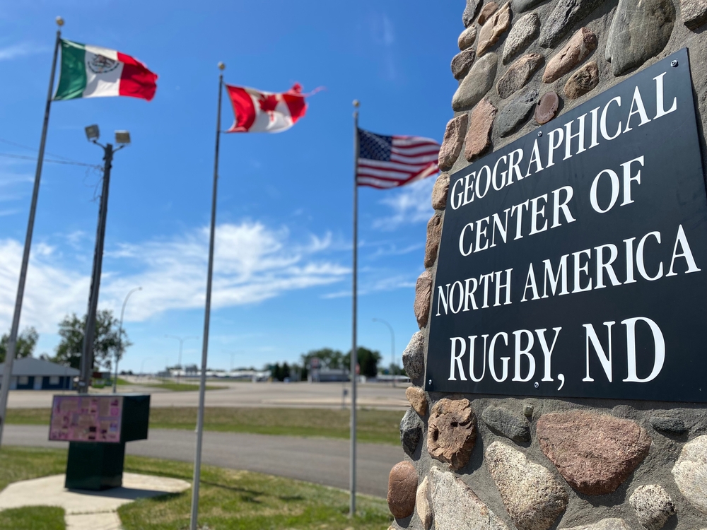
In North Dakota’s Rugby City stands a 21-foot-tall obelisk with “Geographical Center of North America” written on its side.
The monument is surrounded by flagpoles, restaurants, and gift shops selling glasses and T-shirts, which can easily convince you that it is truly the Geographical Center of North America.
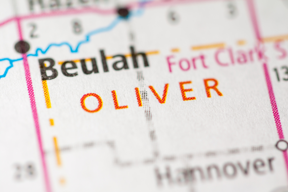
However, this has been a point for debate for several decades now. Rugby City has held the title for 90 years, but the title has exchanged hands and moved to Center, which is coincidentally the central point of Oliver County, North Dakota.
While the geographical center of North America doesn’t matter to many people, we will go ahead and look into some of the theories and postulations put forward.
Tag along!
Table of Contents
The Contention
Center, like Rugby City, has claimed to be the geographical center of North America for years, with the former holding the title informally for nine decades.
Rugby argued that it had nothing to boast about except the prairies, so it was better off with the fame of this imaginary point.
Several people have determined this elusive geographical center over the years, coming up with different points due to the different methods.
The greatest source of variation is the melting ice caps due to global warming, which has shifted the geographical points over the years.
America’s government mapping agencies don’t really recognize these centers of the continent.
They have always complained over the years that they have never designated any geographical centers on the continent.
Another issue that has fueled the contention is the lack of clear guidelines on what a geographical center should be.
The more modern and accurate computer algorithms placed the exact point in Center, North Dakota.
This is according to Peter Rogerson, a professor at the University of Buffalo.
Geographical centers of North America
We will start with the reigning city, then take a look at the former champion.
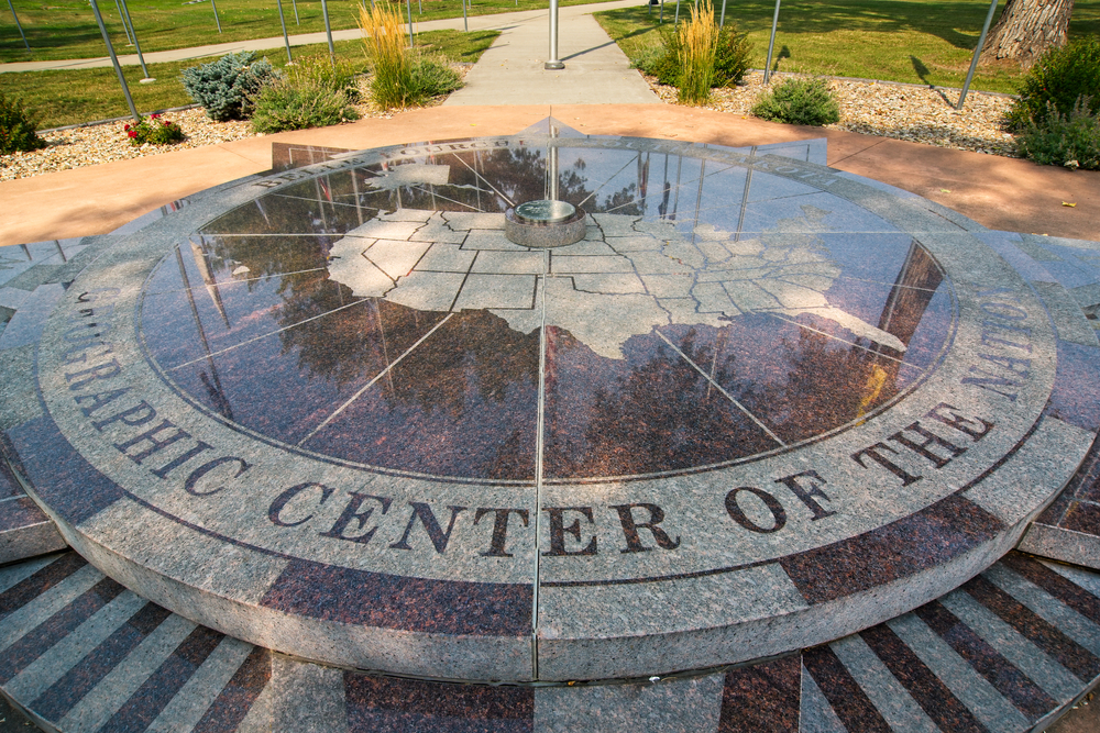
Center, North Dakota
Center, a city in Oliver City, North Dakota, is the reigning geographical center of North America, taking the title from Rugby, a city in North Dakota.
Center also boasts of being the most central point of Oliver County. This comes after Professor Peter Rogerson used latitudes, longitudes, and earth’s reference points to digitally calculate the continent’s center.
Rogerson created a computer algorithm known as the Azimuthal Equidistant Projection and used it to try and crack this point of contention.
Previously, the methods used were physical and based on intuitions more than anything scientific.
Rogerson’s calculations are more accurate because they consider the earth’s curvature, a point that the USGC omitted in the previous estimates.
This may look like a debate between those for and against the flat earth theory. The Azimuthal Equidistant Projection method calculations pointed at the heart of Center City, which is 145 miles from the informal geographical center in Rugby.
Rugby, North Dakota
The United States Geological Survey (USGS) announced that the actual geographical point of North America was a location 15 miles in southwest Rugby in 1928.
The city was delighted because they finally had something to boast about like other counties with significant tourist destinations like the Grand Canyon.
People could hardly wait for the formal announcement and hurriedly built a 15 feet rock monument at the city’s most significant crossroads to commemorate the occasion.
Surprisingly, the city held the title for 90 years before Professor Peter Rogerson came along with his scientific experiments.
Because of the new status, a big city developed and flourished around the monuments because of the traffic created by local and foreign tourists.
While the status has officially moved to another city, the rock monument still remains a popular tourist destination in Rugby.
After all, nobody really knows the definition of a geographical center. It all lies in the mind of those interested.
The Azimuthal Equidistant Projection Method
The method used to previously determine the geographical center did not require any complicated scientific calculations. You just placed the 2D map on a pencil point, and if it balances, that is the geographical point of that area.
However, this method had errors because the earth is a 3D sphere, prompting experts like Rogerson to develop a new method.
Rogerson’s method, the Azimuthal Equidistant Projection, incorporates the third dimension into the two-dimension maps to get more accurate results.
If you are wondering, the difference between a sphere and a flat map is the third dimension – height.
Projecting height on the map produces the actual distance on the ground, making the results more reliable.
Finding a geographical point of the continent is not the first time Rogerson’s method was put to use.
He had experimented with smaller regions, recalculating the geographical centers with great accuracy compared to the methods previously used.
Having tested his computer algorithms and calculations multiple times, Rogerson needed digital records of the continent’s boundaries to complete this feat.
In most areas, scientific results hold more water because they can be verified.
The history of North America’s central geographical point
Here is how everything began and Rugby city rose to fame. Someone, perhaps bored, trying to be creative, or just doing his monotonous duties at the then U.S. Geodetic Survey Office came up with a surprising discovery.
They placed a map cutout made of cardboard on the tip of a pencil and made it balance.
Every object has a center of gravity and will always balance when this point is attained. In this case, the center of balance was a point in Pierce County, North Dakota.
This location was 16 miles from Rugby, the nearest large town. The place then became the unofficial center of North America.
The survey office had never attempted something of this magnitude before. Unfortunately, it would never get a chance to prove whether the employee was right or wrong.
Rugby town was more than delighted to receive the news. The town administration replaced its previous town seal with a rough map of North America depicting Rugby with a big dot.
The town finally had something to boast about. One could now say that they came from North Dakota and gain some recognition from other states.
In the following years, in 1932, the local boys’ scouts group erected a 21-foot-tall fieldstone obelisk where the biggest crossroads in town intersected.
Next to the monument, they hung a big board reading, “Geographical Center of North America.”
The monument and the inscription have stayed in almost the same position since then, with only a slight change in 1971 to pave the way for the expansion of the U.S. Highway 2.
The actual position was not important because the residents were happy as long as it is somewhere in Rugby.
How has Rugby benefitted from its previous status?
Despite not being recognized by government mappers or being affected by the current demoted status, Rugby has benefitted a lot over the years.
The large town finally sprouted into a big city after its newfound status in 1931. For many decades, the monument has served as a tourist attraction, earning the city billions of dollars.
Rugby holds a “Miss Geographical Center” beauty contest every year, attracting models, fashion houses, and sponsors from all over the country.
Several gift shops around the monument sell vast quantities of coffee mugs and N.A. t-shirts with “Geographical Center of North America” printed on them.
You can also get postcards bearing the Department of the Interior Geological Survey Bulletin (DIGSB) page, where the claim was “definitely established.”
Does the monument still exist in rugby?
The monument has been sitting in its current location since 1971. However, huge buildings and other infrastructure have grown in the surrounding areas making it easy to miss the monument.
For instance, it sits in a parking lot belonging to a famous Mexican restaurant and a fitness center.
The investors erected flag poles bearing the U.S., Canadian, and Mexican flags, dwarfing the 21-foot-tall landmark.
However, this lack of height and visibility doesn’t discourage a steady stream of geographically minded tourists from visiting the area.
You can see them posing for photos beside the monument, sitting on benches located beneath the structure, and generally having fun.
Even if Rugby lost the title for the most central geographical point in North America, the fame attributed to the place is still worth it.
What is the geographical center of the United States?
According to the U.S. National Geodetic Survey (NGS), the geographical center of the U.S. is in Belle Fourche, South Dakota.
The point is 29 mi (32km) according to the following geographical readings: 44°58′2.07622″N103°46′17.60283″W. The point changed from the previous one in Lebanon, Kansas, in 1959 after the addition of Hawaii and Alaska.
This is different from the previous geographical center designated in 1912 after the admissions of Arizona and New Mexico to the bigger continuous United States, then composed of 48 individual states.
Lebanon reigned for 47 years until 1959 when it shifted to 550 miles (885 km) northwest.
Note that any measurements of the geographical centers of a landmass will always be inaccurate due to deviations such as changing shorelines.
The current center point lies 12 miles east in a southern corner point where Montana, South Dakota, and Wyoming meet.
It is located precisely on an inhabited piece of private grazing land. According to the NGS datasheet, the actual marker is an irregularly shaped mass of concrete placed 36 inches underground.
After the identification during the 1918 survey, the government set to protect the privacy of the owner of the pastureland.
In 1940, they erected a proxy marker approximately half a mile away. If you visit Belle Fourche, you will find a small concrete slab with a flag on top.
The U.S. Coast and Geodetic Survey Reference Marker is surrounded by the U.S. Center Chapel, a tiny eight-pew chapel, and a picnic area.
What geographical areas make up North America?
When continents are ranked by size, North America ranks 3rd after Asia and Africa. The third-largest continent goes as far as south of the Isthmus of Panama to the small Aleutian Islands of Alaska.
The tiny island countries and territories in the Caribbean Sea, the vast Greenland island, and islands that dot the western North Atlantic Ocean are all part of North America.
Panama hosts the narrowest area of the continent, which is just 31 miles across. Generally, North America is composed of the “new world,” according to Christopher Columbus, who visited the area in 1492.
Canada, Mexico, and the United States of America (USA) are the most thought of countries. Other countries that constitute North America include Caribbean countries like:
The Bahamas
Antigua and Barbuda
Cuba
Dominica
Barbados
Dominican Republic
Haiti
Grenada
Jamaica
Saint Lucia
Nevis and Saint Kitts
Trinidad
The Grenadines and Saint Vincent
Others include dependent British, French, Danish, Dutch, and United States of America (USA) territories.