Historically, rivers have been a source of food, water, water transportation, hydropower, and defense. Rapidly flowing rivers also create waterfalls that generate enough energy to power hydroelectric power stations.
The longest river in Europe is the Volga River. It flows for 294 miles in a southerly direction through Russia and into the Caspian Sea.
Table of Contents
The geography of the Volga River
The world’s largest country, Russia, is split into oblasts, federal republics, okrugs and krajs, two cities of federal rank, and an autonomous area. Because of this broad expanse, Russia is partly in Asia and partly in Europe.
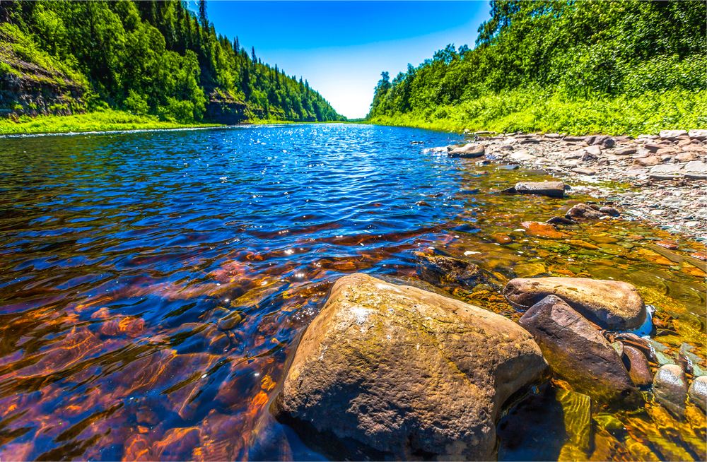
The Volga River flows through the western part of the country, which is located in Europe and is also the region with the highest number of people. The Volga is born in the Valdai Hills, located in the Tver Oblast, specifically in a forest close to a town called Volgo-Verjovie.
It then traverses an overall total of 10 oblasts and three republics.
The Volga River is the longest in Europe, covering almost 600,000 square miles, approximately 40% of European Russia. From its beginnings in the hills of the dense forests close to the Baltic Sea to its mouth at the Caspian Sea 2,300 miles away, the river runs through areas of ancient Russia.
Following the course of the Volga River
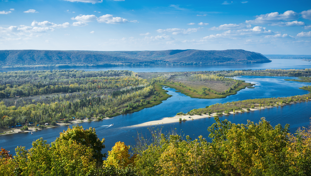
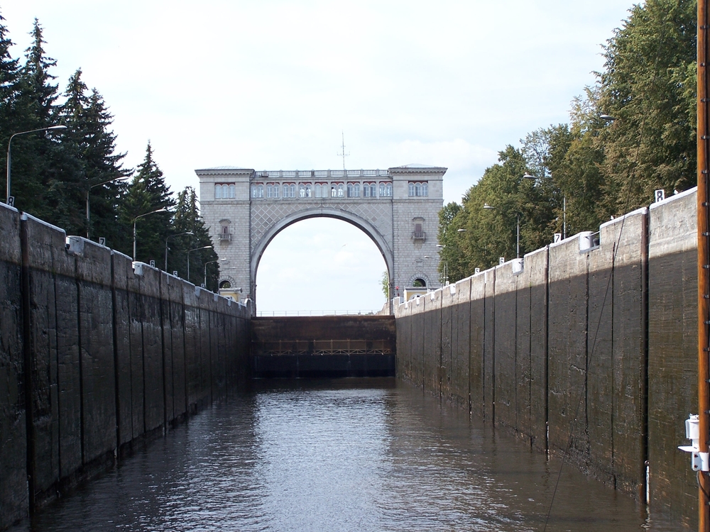
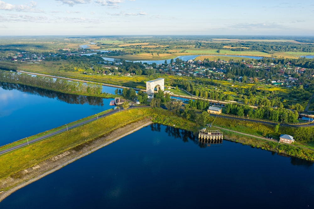
The present-day course of the Volga has been drastically altered due to the development of a series of hydroelectric dams and massive reservoirs constructed by the Soviets between 1930 and 1960. The biggest in Russia, the Samara reservoir, was built to save water from the Volga and its main tributary, the Kama.
This has resulted in a lake that is 375 miles long and covers an area of 2,300 square miles.
Boats can connect to other rivers through a network of canals and tributaries and are able to use the river to travel to the Atlantic from the Volga basin and or get to the Mediterranean from both the Black and Baltic seas.
The history of the Volga River
Throughout Russian history, the Volga has been the line of separation between Orthodox Christianity and the Slavs, between west and east, the steppes of Central Asia, and the nomadic “barbarians” of Siberia. Cities such as Astrakhan and Kazan started out as the strongholds of the Mongols; 15th-century eastward expansion saw these strongholds overrun by Russian forces.
The venerable Russian capital city of Moscow isn’t situated on the Volga. However, it is located on the Moscow River, which flows into the Volga’s second-largest tributary, the Oka River.
The canal was created in 1937 so that, for the first time in history, Moscow had a port.
The topography of the Volga River
The Volga is exceptionally flat from mouth to source and drops just 630 feet across the Valdai Hills (roughly halfway between Moscow and Saint Petersburg) to the Volga Delta’s depression at the mouth of the Caspian Sea. This is one of the lowest spots in all of Europe, being a full 92 feet below sea level.
The vegetation and climate change considerably with the course of the river as the vegetation shifts from semideserts in the south to dense northern forests, to steppes. The river’s delta is large and home to one of Russia’s most sought-after exports – caviar derived from giant Volga sturgeon.
Along with many others, the caviar industry is in danger due to environmental issues such as high levels of metals in the reservoirs and the decline in water levels due to water evaporation and irrigation. There is increasing worry for the 60 million inhabitants and around half of Russia’s agricultural and industrial sectors that are dependent on the river.
Physical attributes of the Volga River
Typical weather conditions on the Volga River
At its source, the Volga is nearly 750 feet above sea level. It descends unhurriedly until – at 92 feet below sea level – it comes to its mouth.
Due to this relatively small difference, the climate along the river is stable with only a few variations.
Because of this lack of fluctuation in temperature in the surrounding environment, the water that flows through the Volga can be cold, often barely above freezing for many months throughout the year. Even at its mouth, the river is ice-free for only about 260 days throughout the year, and the number of ice-free days can be even lower on other parts of the river.
The fauna of the Volga River
The Volga River is home to an abundant diversity despite the problems with pollution it faces. There are many native species like the white-finned gilthead and other non-native species, such as four sturgeon species.
The Volga River delta is a protected area due to the diversity of bird species that use the delta for migration purposes. The most important birds are the Dalmatian Pelican and the Caspian Gull.
Other species seen around the river are mallards, swans, and common and white herons.
In the case of mammals, some typical, well-known species in the region are the Caspian seal and the Russian desman, the latter of which is at risk of disappearing. Other mammals comprise the wolf, otter, and red fox.
The flora of the Volga River
The course of the river’s flow is divided, first in its upper section through the cold and the other in its delta where it converges with the Caspian. In areas along the Volga where human presence is minimal, the flora is diverse and attractive.
The most common trees in the upper Volga include fir and Scots pine while the river’s middle course is rich in poplars, linden, and oaks.
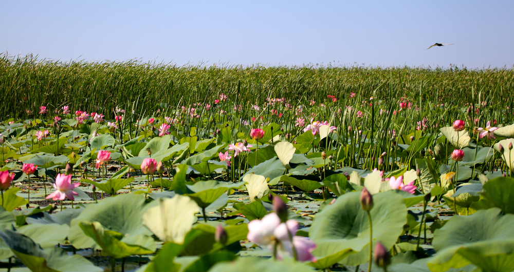
The lower portion of the Volga delta has an abundance of algae, but the lotus flower, typical of the Astrakhan region where the mouth of the river is, stands out because of its beauty. Over 700 types of fungi are found throughout the Volga River.
The tributaries of the Volga River
With its tributaries included, the Volga covers an area of 56,000 square miles. The Volga and its tributaries make up an intricate network the shape of which resembles a eucalyptus tree.
Among the tributaries that contribute to the mighty Volga River, the most important are the Sheksna, Kama, Medveditsa, Mologa, Nerl, Oka, Samara, and Vetluga.
Reservoirs of the Volga River
Other than certain stretches along the Volga, the majority of its route is constantly interrupted by dams and reservoirs.
While the work started before the 20th century, the most significant portion of work is from the beginning of the 1900s. The river currently has a number of the biggest dams anywhere in the world. Among them are the:
1937s Ivankovo Dam
1940s Uglich Dam
1941s Rybinsk Dam
1955s Nijni Novgorodo Dam
1955s Samara Dam
1958s Volgograd Dam
1967s Saratov Dam
1980s Cheboksary Dam
Major cities that lie on the banks of the Volga River
Russia is home to various cities with attractions for both residents and tourists. Of these, several are blessed by the Volga because it runs directly through them or indirectly through the channels connecting different countries’ regions.
The cities through which water from the Volga flows have gained cultural and intellectual significance from their association with the great river. Half of the many cities Russia is home to are near the “mother river.”
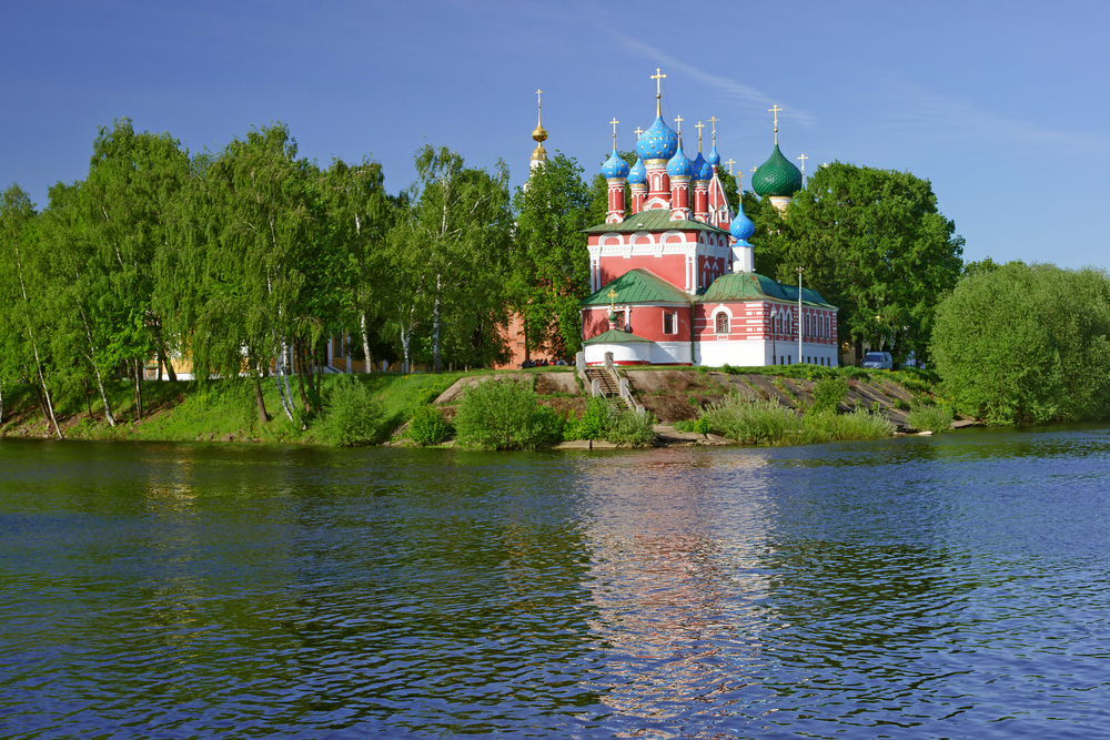
A principal city on the River Volga is Yaroslavl, one of Russia’s oldest cities. Its central area is designated as a World Heritage Site.
Near the middle of the Volga lies the town of Kazan, established by Bulgarians but later destroyed by war. It is now a center for science, politics, culture, and sports.
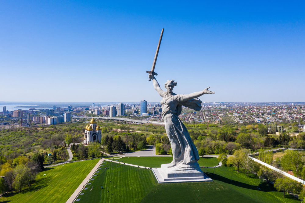
Then, in its lower regions are Volgograd – famous for its part in World War II – and Saratov, known as the center of education in the country.
Contamination in the Volga River
The conditioning to ensure that the Volga is an economically viable resource and a navigable river over an extensive area is also responsible for its high degree of pollution.
While there are other causes, like domestic human waste, the most significant reason for the contamination of waterways is the residues of the oil and gas industry. Alongside the oil itself and its derivatives, alarming iron, nickel, and mercury levels are also found in the Volga.
In 2016, discussions on the restoration and sanitation of the Volga began, which led to the approval of a plan to clean up the river’s water.
WWII and the Volga River
Before it became the popular tourist destination that it is known for today, the Volga River went through the darkest period of history. Along the banks of the Volga in the city known by the name of Stalingrad and later changed to Volgograd in the course of the war, a bloody conflict was waged to defeat Nazi Germany.
The Battle of Stalingrad and the Great Patriotic War in Russia was a conflict between August 1942 and February 1943. It was fought between Nazi Germany and its allies on one side and the USSR on the other.
The Volga River, which divided the city of Stalingrad in two, allowed soviet troops to quickly traverse the river, from one side to another with boats, taking soldiers to the battlefront and bringing back the wounded. Thus, the Volga played a huge part in helping the soviets defeat the Nazis in Russia.
Quick facts about the Volga River
Its source is a natural monument
The source of the Volga has always been regarded as unique. In the past, a small rectangular, wooden chapel was constructed over some of the streams.
In the middle of the chapel is an opening that runs directly over the spring. The chapel can be reached via a tiny wooden bridge across the swampy terrain.
The source of the water is classed as a natural monument.
It exits into the Caspian Sea
The Caspian Sea is a landlocked sea – it doesn’t connect with other oceans or other seas. This means that it isn’t affected by sea-level fluctuations.
The Caspian Sea covers a depression in the ground and the sea’s surface is 92 feet below sea level.
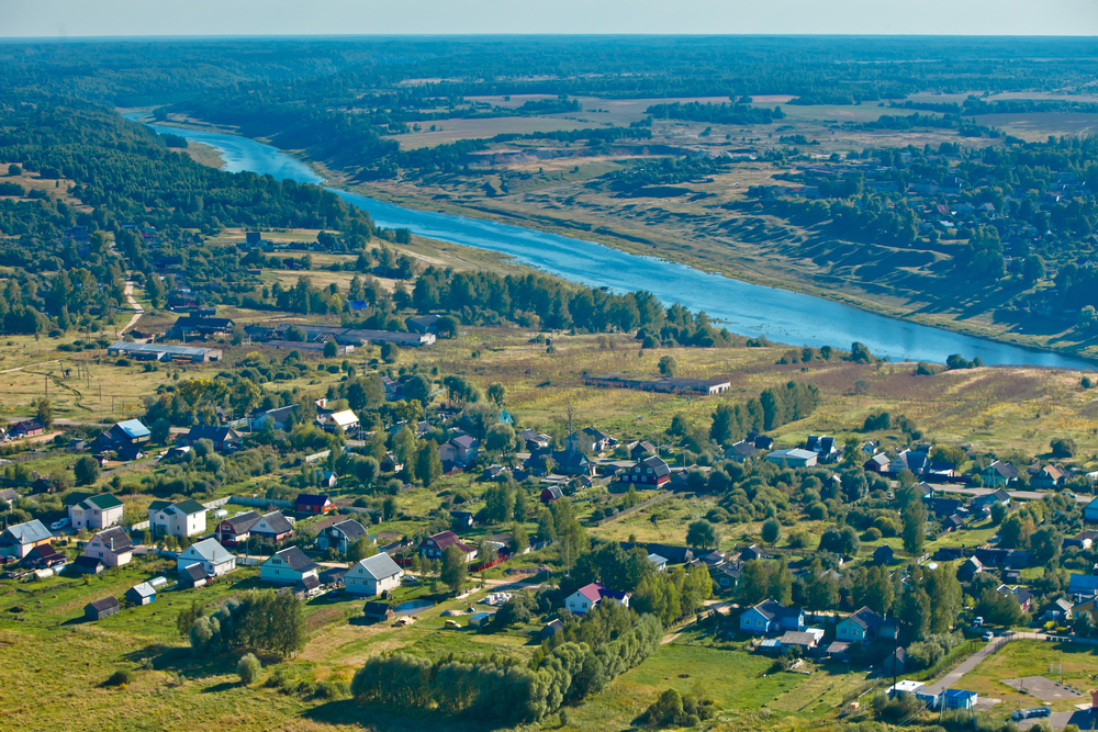
It starts in a swamp
The Volga River originates in a swamp within the Valdai Hills. The Valdai Hills are the apex of a ridge that runs north from the Central Russian Uplands.
It’s situated within northwest Russia, about midway between Moscow and St Petersburg. The Hills can be found at 1125 feet (343 meters). They are home to numerous lakes and are the source of many rivers.