An average of seven million tourists heads over to the beautiful Hoover Dam each year, a historical landmark that spans the Nevada and Arizona border. After the construction of the dam, a beautiful lake was formed that also draws visitors from far and wide.
Table of Contents
What lake did the Hoover Dam create?
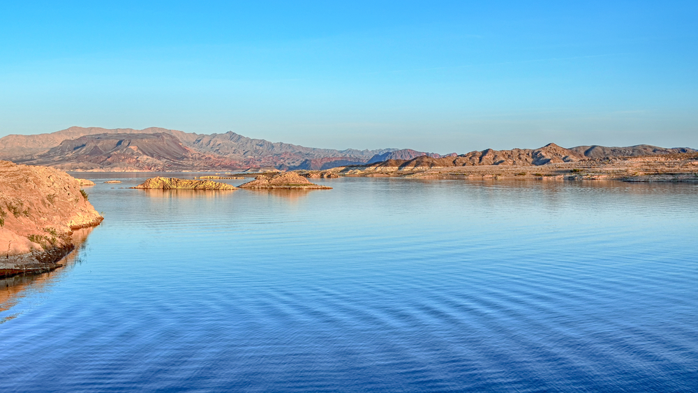
In southern Nevada, the Hoover Dam’s main reservoir is Lake Mead, which straddles the border with Arizona. Lake Mead, a reservoir in the Colorado River’s Lower Basin, was formed as a result of the Hoover Dam.
Stretching for nearly 250 square miles, the reservoir’s volume is the largest in the United States.
The water supply comes from melted snow and overland flow (surface runoff) from the Rocky Mountains. Storage and distribution networks, including Lake Powell, assist with supplying the water for irrigation to this area.
Can you swim in Lake Mead?
Lake Mead serves as the centerpiece for recreation in the area and provides a wide range of water-based activities.
Swimming is a favorite pastime at Lake Mead, even though there are no specified beaches or lifeguards to keep you safe. Numerous marinas are available for boat launching, and there are multiple secret coves just waiting for discovery by kayak or canoe.
Catfish, bass, and several other fish species live in the lake, making it a popular spot for fishing as well.
Is it safe to scuba dive in Lake Mead?
According to the National Park Service, one of the best freshwater lakes for scuba diving is Lake Mead.
Diving in the lake is suitable for both novice and advanced divers. Please keep in mind that the water in the lake constantly fluctuates, and this can have a significant impact on the diving conditions.
There are six dive sites deemed safe by the Park Service. Always check the park services’ website for closures and weather updates.
Areas that may be risky for diving:
The Northern Section of South Cove: Squishy, viscous silt levels a few feet deep cover the bottom of the shallow river channel north of South Cove.
The Colorado River’s silt content causes the water to become murkier the further up the lake you go. At a depth of 5 to 10 feet, you can find the thermocline with water temperatures dipping into the low 50s. Rapids can form and shift suddenly.
Hemenway and PWC Beach: Excessive traffic on Hemenway Harbor’s ski beach and personal watercraft beach make this area risky for divers.
Gypsum Ledges: There may be unstable overhangs that can break from the wind and fall into the water, making this area risky for diving.
Did pioneers live on Lake Mead?
St. Thomas, now an abandoned ghost town, was established in the Lake Mead area in the mid-1860s. Pioneers wanting to explore the unknown territories of the west settled here one year after Nevada was declared a state. However, the town was abandoned in the 1930s due to the rising water levels of Lake Mead.
Once completely submerged by Lake Mead, the town has now been brought to light for intrigued travelers to start exploring. Tourists can visit sections of the city dating back over 150 years when they visit Lake Mead.
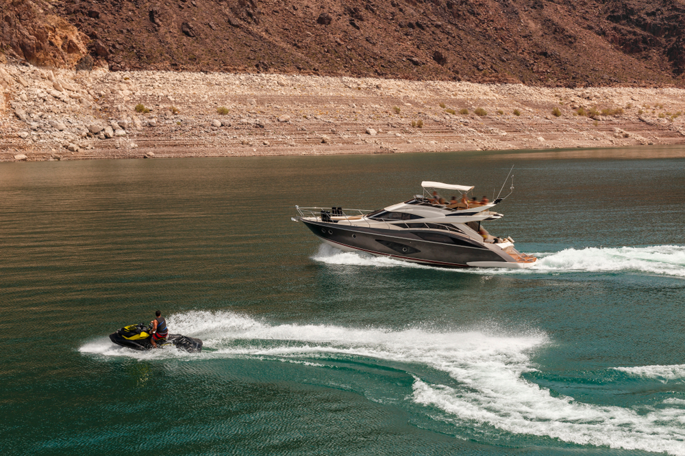
Can motorized vessels operate on Lake Mead?
Both Lakes Mead and Mohave are prominent places to go boating. If you’re in the mood for some open water action, the region’s nearly 300 square miles of waterways are perfect for you.
It is important to note that there are boating regulations for these lakes. In order to ensure a safe and enjoyable boating experience, this page provides information about the park’s numerous launch ramps and boat rental locations.
What are the requirements for boating on Lake Mead?
You will need a vehicle pass as well as passes for each boat if you plan to use the recreational area near Lake Mead. These passes can be purchased at park entrance points.
The state’s boat regulations require that you register and fortify your boat with the proper protective equipment.
If you plan to go boating in Nevada, you must get an AIS decal and put it on your watercraft (except for those with Arizona Registration). You can purchase them online at: https://nevada.licenses.kalkomey.com/products.
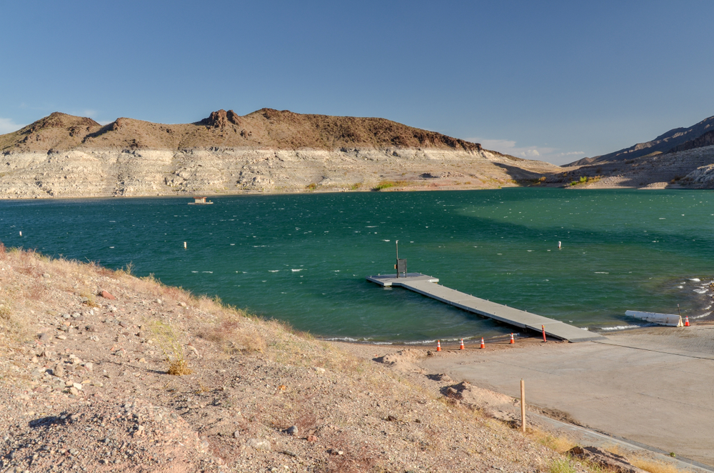
How many launch ramps does Lake Mead have?
Lake Mead has seven launch ramps made of either dirt or concrete, some of which have marinas. Some even allow you to rent boats.
Hemenway Harbor: Inside the Boulder Basin of Lake Mead, you can sail away from Hemenway Harbor. Resources include its launch ramp, marine and auto fuel sales, and a wide range of boat and equipment rental options, including sport boats and pontoon boats. Renting a boat slip is an option as well.
PWC Beach: North of Hemenway Harbor is where you’ll find PWC Beach. You can release your vessel from the beach and even camp right next to your car at PWC.
Boulder Harbor: Boulder Harbor is a popular place for residents to deploy their boats. Just a short drive from the Las Vegas Valley, the concrete launch ramp is both large and spacious. In the close surroundings, there are no establishments, but just around the corner, the Las Vegas Boat Harbor provides fuel, food, and other necessities.
Callville Bay: Awaiting you at Callville Bay is an exciting adventure. If you don’t own a boat, you can rent a personal watercraft like a ski boat or pontoon. The Callville campground or RV park is a great place to stay if you want to wake up right on the lake.
Echo Bay: It is a fisherman’s heaven in Echo Bay. Fishers can fill up at Echo Bay before heading out to Lake Mead’s serene Overton Arm to catch striped bass and largemouth bass.
Temple Bar: If you’re looking to get away from the hustle and loosen up on Lake Mead amid vibrant desert scenery, head to Temple Bar. Rental boats and kayaks are available, as well as cabins, motels, or campgrounds where you can rest your head for the night.
South Cove: South Cove is among the park’s lesser-known destinations, situated on the east end next to a Joshua Tree forest. You can get to several sandy coves by boat from this location.
Why is Lake Mead’s water level decreasing?
Droughts over two decades have led to lower water levels in Lake Mead. Due to a decrease in runoff, it is estimated that Lake Mead’s volume might be 30% below its average by the end of 2022.
Also, because of water loss through evaporation and high demand for water from drought-stricken areas like Nevada, California, and Arizona, the water levels in Lake Mead are decreasing even more.
For the government to make a water shortage declaration in the Lower Basin, Lake Mead’s water level would need to drop to under 1,080 feet. After declaring a water shortage, Nevada and Arizona would receive less water each year.
As a result of the cuts, the Central Arizona Project’s farmers in Arizona would be the hardest hit. Additional water restrictions would continue for users in Arizona, Nevada, California, and Mexico as Lake Mead’s elevation falls.
What consent forms were signed regarding the Lake Mead Basin?
For both Lake Powell and Lake Mead, the Seven States Agreement issued new regulations in 2007. Arizona, California, and Nevada will store water they save in Lake Mead under the agreement terms.
The United States and Mexico signed Minute 319 in 2012. Minute 319 establishes new water-sharing rules for the Colorado River. Mexico may store some of its Colorado River water in Lake Mead under the terms of a five-year agreement, one of several dating back to 1944 on the Colorado River between the United States and Mexico. There are times when Mexico receives less water because of the Lower Basin’s drought.
To keep Lake Mead’s reservoir levels high enough to avoid dramatic cuts to Colorado River users, the United States and Mexico signed Minute 323, an agreement that ensures that Mexico can continue to store its water in Lake Mead.
Both the Upper and Lower Basin states implemented a Drought Contingency Plan in 2019. The Upper Basin plan focuses on reducing water consumption. Lake Mead’s elevation has reached a point where cities and farms in Arizona, California, and Nevada have agreed to scale back and take deeper cuts.
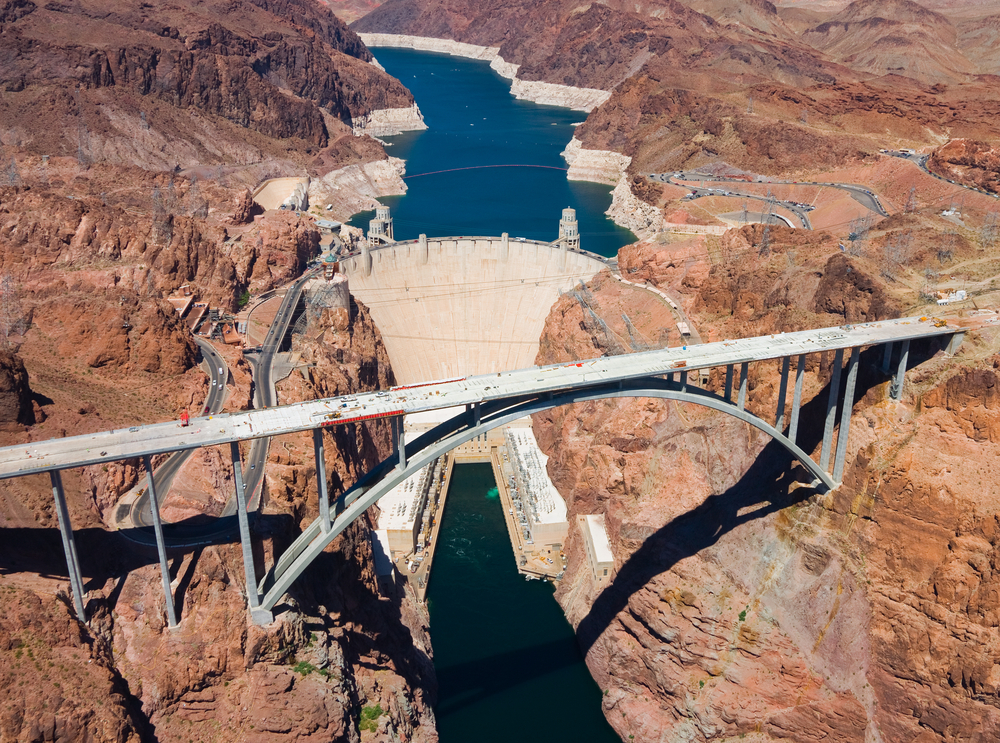
What’s the significance of the Hoover Dam and Lake Mead?
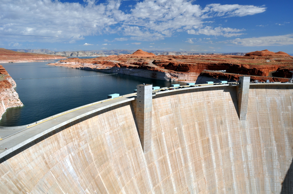
Hoover Dam, among the nation’s tallest man-made structures and a National Historic Landmark, is a vital reservoir for flood mitigation, reservoirs, and water management on the lower Colorado River. All of this attracts visitors from around the world. As a hydroelectric facility, it generates approximately 4 billion kilowatt-hours of power annually, providing electricity to upwards of 1.3 million users in Nevada, Arizona, and California.
The Hoover Dam underwent construction in 1936 to provide irrigation water and hydroelectric power, as well as to regulate the cyclical inundation of the Colorado River, which allowed for the establishment of settlements further down the river.
The Boulder Canyon Project Act of 1928 permitted the development of Hoover Dam, which spans the Nevada-Arizona boundaries around 30 miles to the southeast of Las Vegas.
How did the Hoover Dam get its name?
Before it became known as the Grand Canyon Dam, it was known as the Hoover Dam in commemoration of then-President Herbert Hoover, who had spearheaded discussions to divide Colorado River waterways in 1922. Boulder Dam got renamed after Franklin Roosevelt’s Interior Secretary Harold Ickes took office in 1933. In 1947, Congress renamed it the Hoover Dam.
What are states doing to protect Lake Mead?
With an October 2021 announcement, Arizona Governor Doug Ducey made huge strides forward in the long-term attempt of protecting the Colorado River system, a crucial source of water for Arizona’s neighborhoods, peoples, and farming industry, by investing $30 million.
Governor Ducey said they’re determined to protect the preservation of culture and defend the water systems. “This responsibility gets bolstered by the investments made today. With the help of other states and federal agencies, as well as our community partners and tribal neighbors, we will continue to develop new strategies to ensure Arizona’s water supply for the foreseeable future.”
How does the Drought Contingency Plan affect Lake Mead?
Neighborhoods with entitlements on the Colorado River will benefit from these funds, which the Arizona Department of Water Resources will negotiate with them. The 2021 Drought Contingency Plan (DCP) also included similar measures.
Arizona has taken a number of steps to stabilize Lake Mead‘s surface levels, such as willfully releasing thousands of acre-feet of the yearly allotment into the reservoir prior to the historical framework of DCP’s introduction.
Due to an over-allocation of water across the entire system and the river’s flow decline because of drought, the water level in Lake Mead has dwindled because the Basin has not been completely filled for more than a decade.
With no DCP, Lake Mead’s volumes would’ve been considered critical by late 2021, putting Hoover Dam’s power generation in jeopardy.


")


